Area Overview for B69 3AT
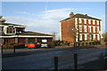
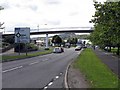
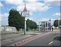
Photos of B69 3AT


Area Information
B69 3AT is a small, tightly packed residential area in England’s West Midlands, nestled within the historic market town of Oldbury. With a population of 2,441 and a density of 1,643 people per square kilometre, this postcode reflects a compact, community-oriented environment. The area’s proximity to Oldbury’s historic core, including landmarks like Christchurch and Albright Recreation Ground, offers residents a blend of local heritage and modern convenience. Daily life here is shaped by its role as part of Sandwell Borough, with access to nearby rail links and a network of primary schools. The median age of 47 suggests a stable, mature population, with a strong presence of adults aged 30–64. While the area lacks large-scale amenities, its small size fosters a sense of familiarity, making it appealing to those prioritising proximity to local services over sprawling urban sprawl. The high broadband score of 98 ensures seamless digital connectivity, supporting both remote work and everyday internet use. However, the area’s character is defined by its practicality, with homes predominantly in private ownership and a focus on family-oriented living.
- Area Type
- Postcode
- Area Size
- Not available
- Population
- 2441
- Population Density
- 1643 people/km²
B69 3AT is a small, owner-occupied area where 56% of homes are privately owned, with the remaining 44% likely rented. The accommodation type is predominantly houses, which aligns with the area’s suburban character and the absence of high-density housing. This suggests a market skewed towards family homes and long-term residency, rather than transient rental properties. The compact nature of the postcode, combined with the high population density, indicates limited housing stock, which could drive competition among buyers. For those seeking properties, the focus on houses rather than flats may appeal to those prioritising space and privacy. However, the area’s small size means the immediate surroundings are critical for access to amenities, schools, and transport. Buyers should consider the proximity to nearby rail and metro stations, which are vital for commuting, given the lack of major urban infrastructure within the postcode itself.
House Prices in B69 3AT
No properties found in this postcode.
Energy Efficiency in B69 3AT
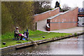
The lifestyle in B69 3AT is shaped by its proximity to retail, transport, and recreational spaces. Nearby shops include Sainsburys Oldbury, Iceland Oldbury, and Spar, offering essential grocery and convenience services. The area’s rail and metro connections provide access to broader networks, while the nearby Albright Recreation Ground offers open space for leisure and exercise. Though the postcode itself is small, the surrounding area includes historical sites like Christchurch and the Old Courthouse, adding cultural value. The absence of large-scale amenities means daily life revolves around local services, but the density of nearby stations and shops ensures practicality. For families, the combination of schools, retail, and green spaces creates a balanced environment, though those requiring specialist facilities may need to travel further. The area’s charm lies in its compactness, where convenience and community coexist.
Amenities
Schools
B69 3AT is served by multiple primary schools, including Rounds Green Primary School, Rounds Green Junior School, Rounds Green Infant School, and a second listing of Rounds Green Primary School with an Ofsted rating of ‘good’. These institutions provide a range of primary education options for families, with the repeated name suggesting potential for expanded capacity or multiple campuses. The presence of three distinct primary schools catering to different age groups (infants, juniors, and general primary) ensures coverage for children from early years through to primary school exit. The ‘good’ Ofsted rating for one of the schools indicates a reliable standard of education, though the overall quality of the others is not specified. Families in the area benefit from a concentrated network of primary schools, reducing the need for long commutes for children’s education.
| Rank | School | Type | Entry gender | Ages |
|---|
Explore more schools in this area
Go to Schools tabDemographics
The population of B69 3AT is predominantly composed of adults aged 30–64, with a median age of 47. This suggests a mature, established community, likely with a high proportion of long-term residents. Home ownership stands at 56%, indicating a mix of owner-occupied properties and rental units, though the exact rental share is not specified. The area is characterised by houses rather than flats, reflecting a suburban or semi-rural housing stock. The predominant ethnic group is White, though specific diversity metrics are not provided. The population density of 1,643 people per square kilometre implies a closely knit community, which may influence local social dynamics. While no explicit deprivation data is available, the high broadband score and proximity to schools suggest reasonable access to essential services. However, the area’s small size and limited amenities may pose challenges for those requiring specialist facilities.
Household Size
Accommodation Type
Tenure
Ethnic Group
Religion
Household Composition
Age
Household Deprivation
NS-SEC
Explore more demographic insights in this area
Go to Demographics tabPlanning
Planning Constraints
- Flood RiskPremium
- Ramsar Wetland SitesPremium
- Area of Outstanding Natural BeautyPremium
- Protected Nature ReservePremium
- Protected WoodlandPremium