Area Overview for B69 2FG
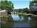
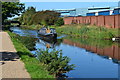
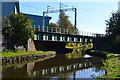
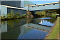
Photos of B69 2FG
Area Information
Living in B69 2FG means being part of a tightly knit residential cluster in the West Midlands, nestled within the historically industrious town of Oldbury. With a population of 2,441 and a density of 1,643 people per square kilometre, this area reflects the legacy of Oldbury’s past as a hub of ironworks and coal mining. The community is predominantly composed of adults aged 30–64, with a median age of 47, suggesting a stable, mature demographic. The area’s compact size means amenities and services are closely clustered, with easy access to rail networks, retail outlets, and green spaces. While the industrial heritage remains, modern life here is defined by proximity to transport links and a mix of traditional and contemporary housing. For buyers, B69 2FG offers a blend of historical character and practical living, though its small size means the housing stock is limited to a few hundred homes, mostly owner-occupied. The area’s compact nature ensures that daily life is efficient, with everything within walking or short-driving distance.
- Area Type
- Postcode
- Area Size
- Not available
- Population
- 2441
- Population Density
- 1643 people/km²
The property market in B69 2FG is characterised by a 56% home ownership rate, with houses forming the majority of the accommodation stock. This suggests a stable, owner-occupied market, likely dominated by semi-detached or terraced homes typical of smaller towns. The limited size of the area means the housing stock is not vast, and buyers may find fewer options compared to larger urban centres. The predominance of owner-occupied properties indicates a community of long-term residents rather than a transient rental market. For buyers, this could mean fewer new developments but potentially more established homes with historical character. However, the small scale of the area means property availability is constrained, and proximity to transport links may be a key selling point for those prioritising connectivity over expansive living space.
House Prices in B69 2FG
No properties found in this postcode.
Energy Efficiency in B69 2FG
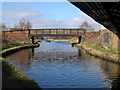
The lifestyle in B69 2FG is shaped by its proximity to retail, transport, and green spaces. Local shops include Sainsburys Oldbury, Iceland Oldbury, and Spar, offering convenience for daily needs. Rail and metro stations like Sandwell & Dudley Railway Station and Lodge Road provide easy access to nearby towns and cities. Recreational options include Albright Recreation Ground, which features sports pitches, an ornamental pool, and flowerbeds, offering a space for outdoor activities. The area’s historical character is complemented by modern amenities, creating a balance between tradition and practicality. For residents, the compact layout ensures that shops, transport, and leisure facilities are all within short distances, supporting a lifestyle that prioritises efficiency and accessibility.
Amenities
Schools
Residents of B69 2FG have access to multiple primary schools, including Rounds Green Primary School, Rounds Green Junior School, and Rounds Green Infant School. Notably, Rounds Green Primary School holds an Ofsted rating of ‘good’, indicating a solid educational standard. The presence of three distinct primary schools suggests a focus on early education, though no secondary schools are listed in the data. This mix of primary schools may offer families flexibility in choosing schools for younger children, but parents seeking secondary education would need to look beyond the immediate area. The concentration of primary schools reflects the community’s emphasis on family-oriented living, with schools serving as a central feature of daily life for many residents.
| Rank | School | Type | Entry gender | Ages |
|---|
Explore more schools in this area
Go to Schools tabDemographics
The population of B69 2FG is 2,441, with a median age of 47, indicating a mature, established community. The majority of residents fall within the 30–64 age range, suggesting a mix of working-age adults and older individuals. Home ownership is at 56%, with houses being the predominant type of accommodation. This reflects a settled population, less reliant on rental housing. The predominant ethnic group is White, though no specific data on diversity or deprivation levels is provided. The high population density of 1,643 people per square kilometre implies a compact, possibly urbanised environment. For quality of life, this density may mean limited private outdoor space but proximity to services and transport. The age profile suggests a community with a strong presence of professionals and families, though the absence of specific data on income or deprivation means broader socio-economic context remains unclear.
Household Size
Accommodation Type
Tenure
Ethnic Group
Religion
Household Composition
Age
Household Deprivation
NS-SEC
Explore more demographic insights in this area
Go to Demographics tabPlanning
Planning Constraints
- Flood RiskPremium
- Ramsar Wetland SitesPremium
- Area of Outstanding Natural BeautyPremium
- Protected Nature ReservePremium
- Protected WoodlandPremium