Area Overview for B69 2DL
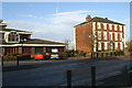
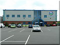
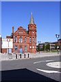
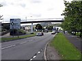
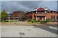
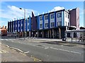
Photos of B69 2DL


Area Information
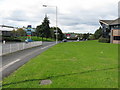
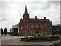
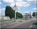
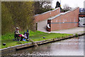
Living in B69 2DL means being part of a tightly knit residential cluster in Oldbury, a market town in Sandwell, West Midlands. With a population of 2,441 and a density of 1,643 people per square kilometre, this area reflects a compact, mature community. The town’s industrial heritage—rooted in ironworks, canals, and coal mining—still shapes its character, though today it is defined by its quiet residential streets and proximity to modern amenities. Residents benefit from easy access to rail and metro links, with stations like Sandwell & Dudley and Langley Green within reach. The area’s demographic profile, dominated by adults aged 30–64, suggests a stable, family-oriented environment. Daily life here balances practicality with historical charm, from the 19th-century Albright Recreation Ground to the modern retail options at Sainsburys Oldbury. While the population is small, the area’s connectivity and amenities make it a viable choice for those seeking a blend of convenience and community.
- Area Type
- Postcode
- Area Size
- Not available
- Population
- 2441
- Population Density
- 1643 people/km²
The property market in B69 2DL is characterised by a strong presence of owner-occupied homes, with 56% of properties owned by residents rather than rented. This suggests a community of established residents who have invested in long-term living. The accommodation type is predominantly houses, which may indicate a mix of detached and semi-detached properties. Given the area’s small size and high population density, the housing stock is likely limited, meaning buyers should consider nearby areas for more options. The focus on owner-occupation implies a stable market, though the small postcode area may mean properties are closely held. For buyers, this could mean competition for available homes, particularly if they align with the local preference for houses. The lack of rental properties also suggests a lower turnover rate, which may appeal to those seeking a settled, low-maintenance environment.
House Prices in B69 2DL
No properties found in this postcode.
Energy Efficiency in B69 2DL
The lifestyle in B69 2DL is shaped by its proximity to essential amenities and community hubs. Retail options include Iceland Oldbury, Sainsburys Oldbury, and Spar, providing access to groceries and everyday essentials. For transport, residents can utilise nearby rail stations such as Sandwell & Dudley and Langley Green, as well as metro stops like Dartmouth Street and West Bromwich Central, ensuring easy travel to nearby towns and cities. The area’s historical roots are reflected in its parks and public spaces, such as Albright Recreation Ground, which offers sports facilities and open spaces for leisure. While the data does not list specific dining or cultural venues, the town’s market town status suggests a range of local businesses and community events. The blend of practical amenities and historical character creates a lifestyle that is both convenient and rooted in tradition, appealing to those seeking a balanced approach to daily living.
Amenities
Schools
Residents of B69 2DL have access to multiple primary schools, including Rounds Green Primary School, Rounds Green Junior School, and Rounds Green Infant School. A fourth school, also named Rounds Green Primary School, holds an Ofsted rating of ‘good’. This concentration of primary schools suggests a strong focus on early education, which is particularly beneficial for families with young children. The presence of both infant and junior schools indicates a comprehensive educational offering for primary-aged pupils. While no secondary schools are listed, the proximity to Oldbury’s town centre may provide access to broader educational facilities. The ‘good’ Ofsted rating at one of the primary schools signals a reliable standard of education, though prospective parents should verify current performance and availability. The variety of school types ensures that families can choose between different educational approaches, from early years to preparatory stages.
| Rank | School | Type | Entry gender | Ages |
|---|
Explore more schools in this area
Go to Schools tabDemographics
B69 2DL has a median age of 47, with the majority of residents falling within the 30–64 age range. This suggests a community skewed towards middle-aged adults, likely including families and professionals. Home ownership stands at 56%, indicating a mix of long-term residents and owner-occupied properties. The predominant accommodation type is houses, which aligns with the area’s residential character. The population is largely composed of White residents, though specific data on other ethnic groups is not provided. The high population density—1,643 people per square kilometre—reflects the area’s compact nature, which may influence social dynamics and local services. While no deprivation data is explicitly stated, the lack of planning constraints and low flood risk suggest a stable environment. However, the high crime risk score of 24/100—well below average—implies residents may need to consider security measures for their homes and personal safety.
Household Size
Accommodation Type
Tenure
Ethnic Group
Religion
Household Composition
Age
Household Deprivation
NS-SEC
Explore more demographic insights in this area
Go to Demographics tabPlanning
Planning Constraints
- Flood RiskPremium
- Ramsar Wetland SitesPremium
- Area of Outstanding Natural BeautyPremium
- Protected Nature ReservePremium
- Protected WoodlandPremium