Area Overview for B69 1UQ
Photos of B69 1UQ

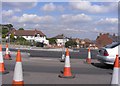
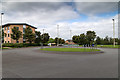


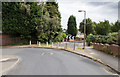
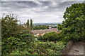


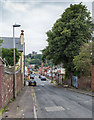

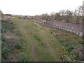
98 photos from this area
Area Information
Key information about the B69 1UQ including its size, population, and administrative classification.
- Area Type
- Postcode
- Area Size
- 8747 m²
- Population
- 1563
- Population Density
- 5968 people/km²
House Prices in B69 1UQ
28
Properties
£127,018
Average Sold Price
£51,000
Lowest Price
£222,000
Highest Price
Showing 28 properties
| Address | Type | Beds | Baths | Last Sale Price | Last Sale Date | |
|---|---|---|---|---|---|---|
| 21 Penrice Drive, Tividale, Oldbury, B69 1UQ | house | - | - | £222,000 | Jul 2024 | |
| 14 Penrice Drive, Tividale, Oldbury, B69 1UQ | house | 3 | 1 | £200,000 | Dec 2023 | |
| 12 Penrice Drive, Tividale, Oldbury, B69 1UQ | Semi-detached | 3 | 1 | £195,000 | Mar 2023 | |
| 10 Penrice Drive, Tividale, Oldbury, B69 1UQ | house | - | - | £192,500 | Aug 2021 | |
| 22 Penrice Drive, Tividale, Oldbury, B69 1UQ | Semi-detached | 3 | 2 | £190,000 | Jul 2020 | |
| 32 Penrice Drive, Tividale, Oldbury, B69 1UQ | Semi-detached | 3 | 1 | £180,500 | Sep 2019 | |
| 20 Penrice Drive, Tividale, Oldbury, B69 1UQ | Semi-detached | 3 | - | £128,000 | Feb 2016 | |
| 18 Penrice Drive, Tividale, Oldbury, B69 1UQ | Terraced | 3 | - | £110,500 | Dec 2010 | |
| 2 Penrice Drive, Tividale, Oldbury, B69 1UQ | house | - | - | £125,000 | Oct 2009 | |
| 19 Penrice Drive, Tividale, Oldbury, B69 1UQ | house | - | - | £130,000 | Sep 2008 |
Page 1 of 3
Energy Efficiency in B69 1UQ
Amenities
Schools
| Rank | School | Type | Entry gender | Ages |
|---|
Explore more schools in this area
Go to Schools tabDemographics
Household Size
Family (3-5 people)
most common
Accommodation Type
Houses
most common
Tenure
78
majority
Ethnic Group
White
most common
Religion
N/A
most common
Household Composition
N/A
most common
Age
47
median
Adults (30-64 years)
most common
Household Deprivation
N/A
with no deprivation
NS-SEC
25
in Lower managerial occupations
Explore more demographic insights in this area
Go to Demographics tabPlanning
Planning Constraints
- Flood RiskPremium
- Ramsar Wetland SitesPremium
- Area of Outstanding Natural BeautyPremium
- Protected Nature ReservePremium
- Protected WoodlandPremium