Area Overview for B69 1SY
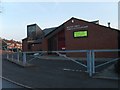
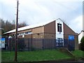
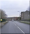
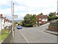
Photos of B69 1SY

Area Information
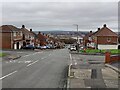
B69 1SY is a small residential postcode in the Sandwell area of England, nestled near Rowley Regis and historically linked to the Tividale ward. With a population of 1,631, it reflects a tight-knit community shaped by its industrial past. The area developed around 19th-century coal mining and manufacturing, with housing estates like Grace Mary and Tividale Hall built in the 1930s and 1950s. Today, it lies south of the A4123 Birmingham New Road, a major artery connecting Birmingham, Dudley, and Wolverhampton. The postcode covers a cluster of homes, many of which are traditional houses, reflecting a stable, long-term resident base. Daily life here balances proximity to transport links with a quiet residential character. The median age of 47 suggests a mature community, with many households established in the area for decades. While the population figure appears smaller than broader ward data, the postcode’s focus on specific clusters means it offers a distinct, manageable scale for those seeking a localised living environment.
- Area Type
- Postcode
- Area Size
- Not available
- Population
- 1631
- Population Density
- 4355 people/km²
The property market in B69 1SY is characterised by a 47% home ownership rate, indicating a balance between owner-occupied and rental properties. The predominant accommodation type is houses, which suggests a focus on family homes rather than flats or apartments. This aligns with the area’s historical development as a residential cluster, with estates like Grace Mary and Tividale Hall built in the mid-20th century. The presence of houses may appeal to buyers seeking space and stability, though the small postcode size means the housing stock is limited. For those considering the area, the mix of ownership and rental options could offer flexibility, but the small scale of B69 1SY means buyers may need to look beyond immediate surroundings for more extensive choices. The lack of high-rise or modern developments suggests a traditional, low-density character, which may suit those prioritising established neighbourhoods over newer, high-density housing.
House Prices in B69 1SY
No properties found in this postcode.
Energy Efficiency in B69 1SY
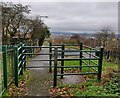
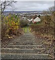
The lifestyle in B69 1SY is shaped by its proximity to retail, rail, and metro services. Within practical reach are five retail outlets, including Spar, Co-op Oldbury, and Iceland Oldbury, offering everyday shopping needs. The area’s railway stations—Sandwell & Dudley, Rowley Regis, and Langley Green—provide access to broader networks, while metro stops like Dartmouth Street and Lodge Road connect to local transport routes. Though the data does not mention parks or leisure facilities, the presence of multiple retail and transport hubs suggests a convenient, community-focused environment. The mix of shops and transport options supports a practical, accessible lifestyle, ideal for those prioritising ease of movement and local amenities over expansive recreational spaces.
Amenities
Schools
Residents of B69 1SY have access to two primary schools: Grace Mary Primary School, which holds an Ofsted rating of outstanding, and Oakham Primary School, rated good. Both institutions cater to younger children, providing a foundation for primary education. The Oakham Centre, listed as an "other" educational facility, may offer additional community services or extracurricular activities. The presence of two primary schools with strong ratings suggests a focus on early education, though the absence of secondary schools means families may need to travel to nearby areas for further schooling. The mix of primary and supplementary facilities indicates a community prioritising accessible, high-quality education for young children, but long-term planning for secondary schooling should be considered.
| Rank | School | Type | Entry gender | Ages |
|---|---|---|---|---|
| 1 | Grace Mary Primary School | primary | N/A | N/A |
| 2 | Oakham Primary School | primary | N/A | N/A |
| 3 | The Oakham Centre | other | N/A | N/A |
Explore more schools in this area
Go to Schools tabDemographics
The population of B69 1SY is 1,631, with a median age of 47, indicating a community dominated by adults aged 30–64. This age range suggests a stable, long-term resident base with families and professionals likely to have established careers and households. Home ownership stands at 47%, slightly below the national average, pointing to a mix of owner-occupied and rental properties. The predominant accommodation type is houses, which aligns with the area’s historical development as a residential cluster. The predominant ethnic group is White, reflecting the broader demographic trends in Sandwell. While specific data on deprivation is absent, the age profile and home ownership rate suggest a community with moderate economic stability. The absence of detailed diversity metrics means the area’s social composition remains largely defined by its majority White population, though this does not preclude smaller, underrepresented groups.
Household Size
Accommodation Type
Tenure
Ethnic Group
Religion
Household Composition
Age
Household Deprivation
NS-SEC
Explore more demographic insights in this area
Go to Demographics tabPlanning
Planning Constraints
- Flood RiskPremium
- Ramsar Wetland SitesPremium
- Area of Outstanding Natural BeautyPremium
- Protected Nature ReservePremium
- Protected WoodlandPremium
- Crime RiskPremium