Area Overview for B69 1NQ
Photos of B69 1NQ

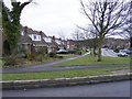
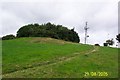

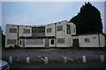
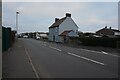
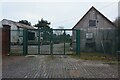

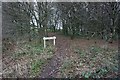
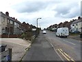


24 photos from this area
Area Information
Key information about the B69 1NQ including its size, population, and administrative classification.
- Area Type
- Postcode
- Area Size
- 4.9 hectares
- Population
- 2315
- Population Density
- 5403 people/km²
House Prices in B69 1NQ
62
Properties
£181,543
Average Sold Price
£99,950
Lowest Price
£425,000
Highest Price
Showing 62 properties
| Address | Type | Beds | Baths | Last Sale Price | Last Sale Date | |
|---|---|---|---|---|---|---|
| 2 Wakeman Drive, Tividale, Oldbury, B69 1NQ | Detached | 3 | 2 | £425,000 | Apr 2024 | |
| 37 Wakeman Drive, Tividale, Oldbury, B69 1NQ | house | - | - | £345,000 | Jul 2021 | |
| 3 Wakeman Drive, Tividale, Oldbury, B69 1NQ | Detached | 3 | 3 | £240,000 | Mar 2021 | |
| 23 Wakeman Drive, Tividale, Oldbury, B69 1NQ | Detached | 4 | 2 | £285,000 | Oct 2020 | |
| 1C Wakeman Drive, Tividale, Oldbury, B69 1NQ | Detached | 4 | - | £253,000 | Mar 2017 | |
| 17 Wakeman Drive, Tividale, Oldbury, B69 1NQ | house | 4 | 3 | £235,000 | Nov 2016 | |
| 1E Wakeman Drive, Tividale, Oldbury, B69 1NQ | Detached | 4 | 2 | £275,000 | Dec 2015 | |
| 20 Wakeman Drive, Tividale, Oldbury, B69 1NQ | Semi-detached | 3 | 1 | £160,000 | Jul 2015 | |
| 4 Wakeman Drive, Tividale, Oldbury, B69 1NQ | Detached | 3 | 2 | £165,000 | Jan 2015 | |
| 27 Wakeman Drive, Tividale, Oldbury, B69 1NQ | Detached | 3 | 2 | £167,500 | Aug 2014 |
Page 1 of 7
Energy Efficiency in B69 1NQ
Amenities
Schools
| Rank | School | Type | Entry gender | Ages |
|---|
Explore more schools in this area
Go to Schools tabDemographics
Household Size
Family (3-5 people)
most common
Accommodation Type
Houses
most common
Tenure
77
majority
Ethnic Group
White
most common
Religion
N/A
most common
Household Composition
N/A
most common
Age
47
median
Adults (30-64 years)
most common
Household Deprivation
N/A
with no deprivation
NS-SEC
28
in Lower managerial occupations
Explore more demographic insights in this area
Go to Demographics tabPlanning
Planning Constraints
- Flood RiskPremium
- Ramsar Wetland SitesPremium
- Area of Outstanding Natural BeautyPremium
- Protected Nature ReservePremium
- Protected WoodlandPremium