Area Overview for B69 1NN
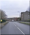
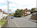
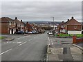
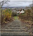
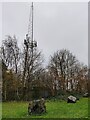
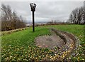
Photos of B69 1NN


Area Information
B69 1NN lies within the Tividale ward of Sandwell, a historically industrial area shaped by coal mining, quarrying, and manufacturing. The postcode covers a small residential cluster with a population of 1,631, nestled south of the A4123 Birmingham New Road. This area is bordered by places like Rowley Regis and sits near the New Main Line Canal, a relic of 19th-century industry. Daily life here is grounded in its working-class roots, with a mix of post-war housing estates and older terraced homes. The community is close-knit, with local landmarks like Grace Mary Estate and Tividale Quays reflecting decades of development. While the area lacks the grandeur of newer suburbs, its proximity to rail networks and essential amenities offers practical living. Residents benefit from a blend of historical character and modern connectivity, making it a pragmatic choice for those seeking affordability without sacrificing access to services. The postcode’s small size means it is tightly integrated with surrounding wards, creating a cohesive local identity.
- Area Type
- Postcode
- Area Size
- Not available
- Population
- 1631
- Population Density
- 4355 people/km²
B69 1NN is characterised by a housing stock dominated by houses rather than flats, reflecting its suburban and semi-rural nature. With 47% of residents owning their homes, the area is not heavily reliant on the rental market, though a significant portion of properties are likely let to tenants. The predominance of houses suggests a focus on family homes, which may appeal to buyers seeking space and privacy. However, the small size of the postcode means the housing stock is limited, and buyers may need to look beyond B69 1NN to find a wider range of properties. The mix of owner-occupied and rental properties indicates a balanced but modest market. Given the area’s historical development, properties may include post-war estates and older terraced homes, offering character and affordability. Buyers should consider the proximity to transport links and amenities when evaluating the area’s appeal.
House Prices in B69 1NN
No properties found in this postcode.
Energy Efficiency in B69 1NN
Residents of B69 1NN have access to a range of local amenities within practical reach. Retail options include Spar, Co-op Oldbury, and Iceland Oldbury, providing everyday shopping convenience. The area’s proximity to rail and metro stations enhances mobility, connecting residents to broader networks of services and leisure opportunities. While specific parks or recreational spaces are not detailed in the data, the historical industrial landscape suggests potential for green spaces near former quarries or canals. The presence of community hubs like The Oakham Centre may offer social or cultural activities. Overall, the lifestyle in B69 1NN balances practicality with the remnants of its industrial past, offering essential services and transport links without the need for long commutes. The mix of retail and transport options supports a functional daily life, though further exploration of nearby areas may be required for more extensive leisure facilities.
Amenities
Schools
Residents of B69 1NN have access to two primary schools with strong Ofsted ratings. Grace Mary Primary School, which serves the area, holds an outstanding rating, reflecting high standards in education. Oakham Primary School, also nearby, has a good rating, providing a reliable option for families. The Oakham Centre, listed as an “other” school, may offer additional educational or community services. The presence of two primary schools with strong ratings is a significant draw for families, ensuring children have access to quality early education. The mix of school types suggests a focus on foundational learning, though no secondary schools are listed in the data. This means families may need to look to nearby areas for secondary education. The school options align with the area’s demographic profile, supporting its role as a residential hub for families.
| Rank | School | Type | Entry gender | Ages |
|---|
Explore more schools in this area
Go to Schools tabDemographics
The population of B69 1NN is 1,631, with a median age of 47 and the most common age group being adults aged 30–64. This suggests a community with a strong presence of middle-aged residents, likely including families and professionals. Home ownership stands at 47%, indicating a mix of owner-occupied and rental properties. The predominant accommodation type is houses, reflecting a residential profile that contrasts with high-density urban areas. The dominant ethnic group is White, though no specific diversity data is provided. The age distribution implies a stable demographic with limited presence of younger or elderly populations. This profile may appeal to those seeking a settled environment with established infrastructure. However, the lack of data on deprivation or income levels means the area’s economic challenges remain unquantified. The 47% home ownership rate suggests that nearly half of residents rent, which could influence local housing market dynamics and community stability.
Household Size
Accommodation Type
Tenure
Ethnic Group
Religion
Household Composition
Age
Household Deprivation
NS-SEC
Explore more demographic insights in this area
Go to Demographics tabPlanning
Planning Constraints
- Flood RiskPremium
- Ramsar Wetland SitesPremium
- Area of Outstanding Natural BeautyPremium
- Protected Nature ReservePremium
- Protected WoodlandPremium