Area Overview for B69 1DJ
Photos of B69 1DJ
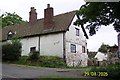
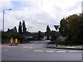
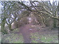
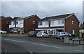
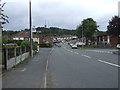
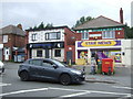

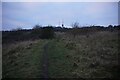
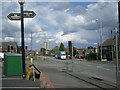
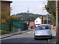

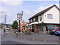
13 photos from this area
Area Information
Key information about the B69 1DJ including its size, population, and administrative classification.
- Area Type
- Postcode
- Area Size
- 1.0 hectares
- Population
- 2370
- Population Density
- 8810 people/km²
House Prices in B69 1DJ
40
Properties
£99,312
Average Sold Price
£58,995
Lowest Price
£180,000
Highest Price
Showing 40 properties
| Address | Type | Beds | Baths | Last Sale Price | Last Sale Date | |
|---|---|---|---|---|---|---|
| 26 Kinnersley Crescent, Oldbury, B69 1DJ | house | - | - | £180,000 | May 2022 | |
| 21 Kinnersley Crescent, Oldbury, B69 1DJ | Terraced | 3 | 1 | £117,000 | Aug 2016 | |
| 10 Kinnersley Crescent, Oldbury, B69 1DJ | Semi-detached | 3 | 1 | £107,000 | Jun 2015 | |
| 8 Kinnersley Crescent, Oldbury, B69 1DJ | Semi-detached | 3 | - | £100,000 | May 2015 | |
| 23 Kinnersley Crescent, Oldbury, B69 1DJ | Terraced | - | - | £84,000 | Nov 2008 | |
| 12 Kinnersley Crescent, Oldbury, B69 1DJ | Semi-detached | - | - | £88,000 | May 2003 | |
| 16 Kinnersley Crescent, Oldbury, B69 1DJ | Semi-detached | - | - | £59,500 | Dec 2001 | |
| 1 Kinnersley Crescent, Oldbury, B69 1DJ | house | - | - | £58,995 | Mar 2001 | |
| 5 Kinnersley Crescent, Oldbury, B69 1DJ | Terraced | 4 | 2 | - | - | |
| 29 Kinnersley Crescent, Oldbury, B69 1DJ | Unknown | - | - | - | - |
Page 1 of 4
Energy Efficiency in B69 1DJ
Amenities
Schools
| Rank | School | Type | Entry gender | Ages |
|---|
Explore more schools in this area
Go to Schools tabDemographics
Household Size
One person
most common
Accommodation Type
Flats
most common
Tenure
37
majority
Ethnic Group
White
most common
Religion
N/A
most common
Household Composition
N/A
most common
Age
47
median
Adults (30-64 years)
most common
Household Deprivation
N/A
with no deprivation
NS-SEC
20
in Lower managerial occupations
Explore more demographic insights in this area
Go to Demographics tabPlanning
Planning Constraints
- Flood RiskPremium
- Ramsar Wetland SitesPremium
- Area of Outstanding Natural BeautyPremium
- Protected Nature ReservePremium
- Protected WoodlandPremium