Area Overview for B68 9QS
Photos of B68 9QS
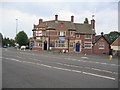
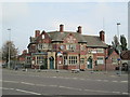

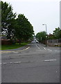
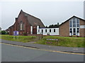
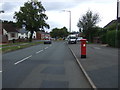

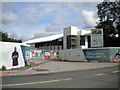
20 photos from this area
Area Information
Key information about the B68 9QS including its size, population, and administrative classification.
- Area Type
- Postcode
- Area Size
- 1.4 hectares
- Population
- 1753
- Population Density
- 6041 people/km²
House Prices in B68 9QS
43
Properties
£128,679
Average Sold Price
£52,500
Lowest Price
£270,000
Highest Price
Showing 43 properties
| Address | Type | Beds | Baths | Last Sale Price | Last Sale Date | |
|---|---|---|---|---|---|---|
| 95 Brookfields Road, Oldbury, B68 9QS | Semi-detached | 2 | 1 | £180,000 | Dec 2023 | |
| 114 Brookfields Road, Oldbury, B68 9QS | house | 3 | 1 | £270,000 | Aug 2022 | |
| 100 Brookfields Road, Oldbury, B68 9QS | house | - | - | £200,000 | Mar 2022 | |
| 87 Brookfields Road, Oldbury, B68 9QS | Semi-detached | 2 | 2 | £130,000 | Feb 2019 | |
| 71 Brookfields Road, Oldbury, B68 9QS | Semi-detached | - | - | £85,500 | Dec 2018 | |
| 77 Brookfields Road, Oldbury, B68 9QS | house | - | - | £148,500 | Nov 2016 | |
| 78 Brookfields Road, Oldbury, B68 9QS | Semi-detached | 3 | 1 | £117,000 | Jun 2012 | |
| 88 Brookfields Road, Oldbury, B68 9QS | house | 3 | - | £97,000 | Feb 2012 | |
| 93 Brookfields Road, Oldbury, B68 9QS | house | - | - | £84,500 | Dec 2010 | |
| 73 Brookfields Road, Oldbury, B68 9QS | house | - | - | £120,000 | Feb 2010 |
Page 1 of 5
Energy Efficiency in B68 9QS
Amenities
Schools
| Rank | School | Type | Entry gender | Ages |
|---|
Explore more schools in this area
Go to Schools tabDemographics
Household Size
Family (3-5 people)
most common
Accommodation Type
Houses
most common
Tenure
58
majority
Ethnic Group
White
most common
Religion
N/A
most common
Household Composition
N/A
most common
Age
47
median
Adults (30-64 years)
most common
Household Deprivation
N/A
with no deprivation
NS-SEC
18
in Lower managerial occupations
Explore more demographic insights in this area
Go to Demographics tabPlanning
Planning Constraints
- Flood RiskPremium
- Ramsar Wetland SitesPremium
- Area of Outstanding Natural BeautyPremium
- Protected Nature ReservePremium
- Protected WoodlandPremium