Area Overview for B68 9NS
Photos of B68 9NS
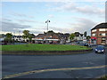
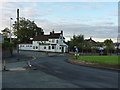
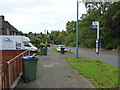
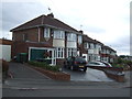

19 photos from this area
Area Information
Key information about the B68 9NS including its size, population, and administrative classification.
- Area Type
- Postcode
- Area Size
- 4779 m²
- Population
- 1705
- Population Density
- 4449 people/km²
House Prices in B68 9NS
14
Properties
£164,488
Average Sold Price
£59,500
Lowest Price
£250,000
Highest Price
Showing 14 properties
| Address | Type | Beds | Baths | Last Sale Price | Last Sale Date | |
|---|---|---|---|---|---|---|
| 11 Conway Avenue, Oldbury, B68 9NS | Semi-detached | 3 | 1 | £234,500 | Feb 2025 | |
| 7 Conway Avenue, Oldbury, B68 9NS | Semi-detached | 3 | 1 | £250,000 | Jan 2025 | |
| 12 Conway Avenue, Oldbury, B68 9NS | house | - | - | £238,000 | Mar 2024 | |
| 2 Conway Avenue, Oldbury, B68 9NS | Semi-detached | 3 | 1 | £225,000 | Mar 2023 | |
| 9 Conway Avenue, Oldbury, B68 9NS | Semi-detached | 3 | 1 | £160,000 | Nov 2019 | |
| 1 Conway Avenue, Oldbury, B68 9NS | Semi-detached | 3 | 1 | £170,000 | Jun 2019 | |
| 8 Conway Avenue, Oldbury, B68 9NS | Semi-detached | 3 | 1 | £150,000 | Jul 2015 | |
| 14 Conway Avenue, Oldbury, B68 9NS | Bungalow | - | - | £194,950 | Sep 2014 | |
| 6 Conway Avenue, Oldbury, B68 9NS | Semi-detached | - | - | £135,000 | Nov 2007 | |
| 5 Conway Avenue, Oldbury, B68 9NS | Semi-detached | - | - | £89,950 | Oct 2001 |
Page 1 of 2
Energy Efficiency in B68 9NS
Amenities
Schools
| Rank | School | Type | Entry gender | Ages |
|---|
Explore more schools in this area
Go to Schools tabDemographics
Household Size
Family (3-5 people)
most common
Accommodation Type
Houses
most common
Tenure
73
majority
Ethnic Group
White
most common
Religion
N/A
most common
Household Composition
N/A
most common
Age
47
median
Adults (30-64 years)
most common
Household Deprivation
N/A
with no deprivation
NS-SEC
29
in Lower managerial occupations
Explore more demographic insights in this area
Go to Demographics tabPlanning
Planning Constraints
- Flood RiskPremium
- Ramsar Wetland SitesPremium
- Area of Outstanding Natural BeautyPremium
- Protected Nature ReservePremium
- Protected WoodlandPremium