Area Overview for B68 9LA
Photos of B68 9LA
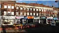
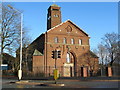
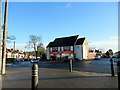
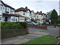
25 photos from this area
Area Information
Key information about the B68 9LA including its size, population, and administrative classification.
- Area Type
- Postcode
- Area Size
- 2.4 hectares
- Population
- 1619
- Population Density
- 4678 people/km²
House Prices in B68 9LA
36
Properties
£233,658
Average Sold Price
£65,000
Lowest Price
£450,000
Highest Price
Showing 36 properties
| Address | Type | Beds | Baths | Last Sale Price | Last Sale Date | |
|---|---|---|---|---|---|---|
| 34 Hadzor Road, Oldbury, B68 9LA | Semi-detached | 3 | 1 | £260,000 | Mar 2023 | |
| 18 Hadzor Road, Oldbury, B68 9LA | Detached | 3 | 1 | £450,000 | Oct 2022 | |
| 14 Hadzor Road, Oldbury, B68 9LA | Detached | 4 | 1 | £389,000 | Mar 2022 | |
| 38 Hadzor Road, Oldbury, B68 9LA | house | - | - | £222,000 | Jan 2018 | |
| 3 Hadzor Road, Oldbury, B68 9LA | Semi-detached | 4 | 2 | £247,000 | Jun 2017 | |
| 12 Hadzor Road, Oldbury, B68 9LA | house | 4 | - | £402,000 | Aug 2016 | |
| 21 Hadzor Road, Oldbury, B68 9LA | Semi-detached | 3 | 2 | £230,000 | Aug 2014 | |
| 5 Hadzor Road, Oldbury, B68 9LA | Semi-detached | 3 | 2 | £230,000 | Mar 2014 | |
| 23 Hadzor Road, Oldbury, B68 9LA | Detached | 4 | - | £295,000 | Mar 2014 | |
| 40 Hadzor Road, Oldbury, B68 9LA | Semi-detached | - | - | £170,000 | Dec 2012 |
Page 1 of 4
Energy Efficiency in B68 9LA
Amenities
Schools
| Rank | School | Type | Entry gender | Ages |
|---|
Explore more schools in this area
Go to Schools tabDemographics
Household Size
Family (3-5 people)
most common
Accommodation Type
Houses
most common
Tenure
82
majority
Ethnic Group
White
most common
Religion
N/A
most common
Household Composition
N/A
most common
Age
47
median
Adults (30-64 years)
most common
Household Deprivation
N/A
with no deprivation
NS-SEC
36
in Lower managerial occupations
Explore more demographic insights in this area
Go to Demographics tabPlanning
Planning Constraints
- Flood RiskPremium
- Ramsar Wetland SitesPremium
- Area of Outstanding Natural BeautyPremium
- Protected Nature ReservePremium
- Protected WoodlandPremium