Area Overview for B68 8ST
Photos of B68 8ST

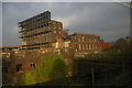
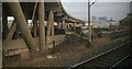
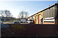
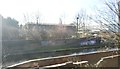


100 photos from this area
Area Information
Key information about the B68 8ST including its size, population, and administrative classification.
- Area Type
- Postcode
- Area Size
- 4.5 hectares
- Population
- 2270
- Population Density
- 2465 people/km²
House Prices in B68 8ST
78
Properties
£168,722
Average Sold Price
£70,000
Lowest Price
£262,000
Highest Price
Showing 78 properties
| Address | Type | Beds | Baths | Last Sale Price | Last Sale Date | |
|---|---|---|---|---|---|---|
| 14 Pel Crescent, Oldbury, B68 8ST | house | - | - | £243,000 | Mar 2024 | |
| 36 Pel Crescent, Oldbury, B68 8ST | Terraced | 3 | 2 | £230,000 | Jan 2024 | |
| 120 Pel Crescent, Oldbury, B68 8ST | Detached | 3 | 2 | £262,000 | Dec 2023 | |
| 142 Pel Crescent, Oldbury, B68 8ST | Terraced | 4 | 2 | £240,000 | Aug 2023 | |
| 124 Pel Crescent, Oldbury, B68 8ST | Retail | 3 | 1 | £240,000 | Sep 2022 | |
| 110 Pel Crescent, Oldbury, B68 8ST | Semi-detached | 3 | - | £217,000 | Jan 2022 | |
| 84 Pel Crescent, Oldbury, B68 8ST | house | - | - | £230,000 | Nov 2021 | |
| 78 Pel Crescent, Oldbury, B68 8ST | house | - | - | £214,000 | Jun 2021 | |
| 96 Pel Crescent, Oldbury, B68 8ST | house | - | - | £169,000 | Jun 2021 | |
| 92 Pel Crescent, Oldbury, B68 8ST | house | - | - | £138,000 | Jul 2020 |
Page 1 of 8
Energy Efficiency in B68 8ST
Amenities
Schools
| Rank | School | Type | Entry gender | Ages |
|---|
Explore more schools in this area
Go to Schools tabDemographics
Household Size
Family (3-5 people)
most common
Accommodation Type
Houses
most common
Tenure
48
majority
Ethnic Group
asian_total
most common
Religion
N/A
most common
Household Composition
N/A
most common
Age
22
median
Adults (30-64 years)
most common
Household Deprivation
N/A
with no deprivation
NS-SEC
15
in Lower managerial occupations
Explore more demographic insights in this area
Go to Demographics tabPlanning
Planning Constraints
- Flood RiskPremium
- Ramsar Wetland SitesPremium
- Area of Outstanding Natural BeautyPremium
- Protected Nature ReservePremium
- Protected WoodlandPremium