Area Overview for B68 8SA
Photos of B68 8SA

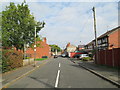
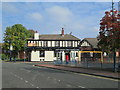
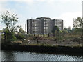
90 photos from this area
Area Information
Key information about the B68 8SA including its size, population, and administrative classification.
- Area Type
- Postcode
- Area Size
- 6490 m²
- Population
- 1999
- Population Density
- 2467 people/km²
House Prices in B68 8SA
17
Properties
£96,300
Average Sold Price
£27,000
Lowest Price
£185,000
Highest Price
Showing 17 properties
| Address | Type | Beds | Baths | Last Sale Price | Last Sale Date | |
|---|---|---|---|---|---|---|
| 69 Wellesley Road, Oldbury, B68 8SA | Terraced | 3 | 1 | £185,000 | Oct 2024 | |
| 77 Wellesley Road, Oldbury, B68 8SA | Terraced | 2 | 1 | £148,500 | Nov 2023 | |
| 75 Wellesley Road, Oldbury, B68 8SA | Terraced | 2 | 1 | £158,000 | May 2023 | |
| 79 Wellesley Road, Oldbury, B68 8SA | Terraced | 2 | 1 | £149,000 | Jan 2023 | |
| 80 Wellesley Road, Oldbury, B68 8SA | house | 2 | - | £114,000 | May 2021 | |
| 82 Wellesley Road, Oldbury, B68 8SA | house | - | - | £127,500 | Dec 2020 | |
| 73 Wellesley Road, Oldbury, B68 8SA | Terraced | 3 | - | £85,000 | Aug 2017 | |
| 78 Wellesley Road, Oldbury, B68 8SA | house | - | - | £75,000 | Nov 2014 | |
| 84 Wellesley Road, Oldbury, B68 8SA | house | 3 | - | £90,000 | Oct 2014 | |
| 67 Wellesley Road, Oldbury, B68 8SA | Terraced | 2 | 1 | £60,000 | Mar 2014 |
Page 1 of 2
Energy Efficiency in B68 8SA
Amenities
Schools
| Rank | School | Type | Entry gender | Ages |
|---|
Explore more schools in this area
Go to Schools tabDemographics
Household Size
Family (3-5 people)
most common
Accommodation Type
Houses
most common
Tenure
51
majority
Ethnic Group
asian_total
most common
Religion
N/A
most common
Household Composition
N/A
most common
Age
47
median
Adults (30-64 years)
most common
Household Deprivation
N/A
with no deprivation
NS-SEC
13
in Lower managerial occupations
Explore more demographic insights in this area
Go to Demographics tabPlanning
Planning Constraints
- Flood RiskPremium
- Ramsar Wetland SitesPremium
- Area of Outstanding Natural BeautyPremium
- Protected Nature ReservePremium
- Protected WoodlandPremium