Area Overview for B68 8QT
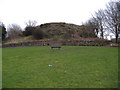
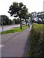
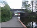
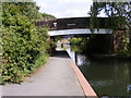
Photos of B68 8QT


Area Information
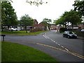
Living in B68 8QT means being part of a tightly knit residential cluster in Sandwell, West Midlands, where history and modernity intersect. The postcode covers 841 m² and is home to 1,529 people, resulting in a high population density of 1,819,134 people per square kilometre. This compact area, historically part of Langley in Oldbury, reflects a blend of industrial heritage and contemporary living. Residents benefit from proximity to Langley Green Railway Station and major roads like the M5 motorway, ensuring connectivity to Birmingham and beyond. The area’s character is shaped by its small-scale residential layout, with homes primarily in the form of houses. While the population density is striking, the community feels manageable, with amenities within walking distance. The presence of multiple schools and retail outlets suggests a focus on family-oriented living, though the area’s compact nature means every choice—whether to live here or commute—carries weight. For those seeking a balance between urban access and a quieter residential setting, B68 8QT offers a distinct, if densely populated, alternative.
- Area Type
- Postcode
- Area Size
- 841 m²
- Population
- 1529
- Population Density
- 3539 people/km²
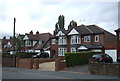
The property market in B68 8QT is characterised by a low home ownership rate of 36%, suggesting that the area is more rental-oriented than owner-occupied. The predominant accommodation type is houses, which are typically larger and more spacious than flats, aligning with the needs of families or individuals seeking private living spaces. Given the small area size of 841 m² and the high population density, housing stock is likely limited, potentially leading to competition among buyers. This dynamic may benefit investors seeking rental properties, but for those prioritising homeownership, the market could be challenging. The focus on houses also implies that properties are likely to be older, with semi-detached or detached designs, which may appeal to buyers seeking space and privacy. However, the compact nature of the area means that any property purchase here must be weighed against the need for proximity to amenities and transport links.
House Prices in B68 8QT
No properties found in this postcode.
Energy Efficiency in B68 8QT
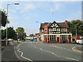
Residents of B68 8QT enjoy a range of amenities within practical reach, enhancing daily life. Retail options include Asda Oldbury, Aldi Langley, and Tesco Birmingham, providing convenience for shopping needs. The area’s rail and metro stations, such as Langley Green and Kenrick Park, offer easy access to public transport, while nearby roads like the M5 motorway facilitate travel to surrounding towns. The presence of multiple schools and community hubs suggests a family-oriented environment, though leisure and dining options are not explicitly detailed in the data. The compact nature of the area means that most errands can be completed without a car, though larger retail or entertainment choices may require a trip to nearby centres. The mix of retail, transport, and educational facilities contributes to a functional, if modest, lifestyle, catering to both practical needs and the desire for connectivity.
Amenities
Schools
Residents of B68 8QT have access to a range of educational institutions, including Langley Primary School, Langley Junior School, and Langley Infant School, all of which are primary schools. Ofsted ratings are available for Langley Primary School and Al Khair Primary School, both of which hold a ‘good’ rating. The presence of The Orchard School, a special needs institution, and Al Khair Primary School, an independent school, adds diversity to the educational landscape. This mix of school types ensures that families have options, whether they seek state-funded education, specialist support for children with additional needs, or independent schooling. The concentration of primary schools within the area suggests a family-friendly environment, with proximity to education being a key factor for homebuyers. However, the lack of secondary schools in the immediate vicinity may necessitate commuting for older children, though nearby towns like Oldbury and Sandwell offer broader educational options.
| Rank | School | Type | Entry gender | Ages |
|---|
Explore more schools in this area
Go to Schools tabDemographics
The community in B68 8QT is predominantly composed of adults aged 30–64, with a median age of 47. This suggests a population skewed towards middle-aged individuals, likely including professionals, families, and retirees. Home ownership stands at 36%, indicating that a significant portion of residents rent their homes, which may influence the local housing market dynamics. The accommodation type is primarily houses, reflecting a preference for standalone or semi-detached properties over flats. The predominant ethnic group is White, though no specific data on diversity or deprivation levels is provided. The age profile implies a stable, established population with potential demand for schools and healthcare services. However, the relatively low home ownership rate could suggest economic pressures or a rental-focused market. For buyers, this demographic mix may mean a community with a strong sense of continuity but limited turnover in property listings.
Household Size
Accommodation Type
Tenure
Ethnic Group
Religion
Household Composition
Age
Household Deprivation
NS-SEC
Explore more demographic insights in this area
Go to Demographics tabPlanning
Planning Constraints
- Flood RiskPremium
- Ramsar Wetland SitesPremium
- Area of Outstanding Natural BeautyPremium
- Protected Nature ReservePremium
- Protected WoodlandPremium