Area Overview for B68 8LH
Photos of B68 8LH


Area Information
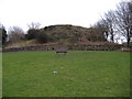
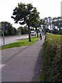
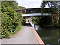
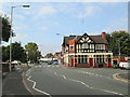
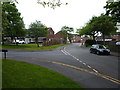
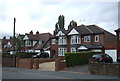
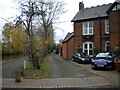
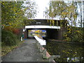
Living in B68 8LH means being part of a small, established residential cluster in Sandwell, West Midlands. The area, part of Langley Ward, sits within the former Oldbury Urban District, a historically industrious region shaped by canals and mineral wealth. With a population of 1,733, it’s a tight-knit community where the median age is 47, reflecting a mature demographic. The area’s character is defined by its quiet residential streets, proximity to rail networks, and a mix of local amenities. Residents benefit from easy access to Langley Green Railway Station and nearby motorways, while the Navigation, a Grade II-listed pub, adds a touch of local heritage. Daily life here balances practicality with a sense of stability, making it appealing to those seeking a settled environment without the bustle of larger cities. The area’s small size means a close-knit community feel, with most homes occupied by owners rather than renters.
- Area Type
- Postcode
- Area Size
- Not available
- Population
- 1733
- Population Density
- 4676 people/km²
The property market in B68 8LH is dominated by owner-occupied homes, with 74% of properties in private ownership. The accommodation type is primarily houses, indicating a lack of high-rise or apartment blocks. This suggests a suburban or semi-rural setting, where larger homes are more common than flats. The small size of the area means the housing stock is limited, which could make the market competitive for buyers. Given the high home ownership rate, the area is less likely to be a rental hotspot, though proximity to transport links like Langley Green Railway Station might attract commuters. For buyers, this means a focus on established properties rather than new developments. The lack of flats or commercial properties also means the market is niche, catering to those seeking a quiet, residential environment with minimal urban density.
House Prices in B68 8LH
No properties found in this postcode.
Energy Efficiency in B68 8LH
Residents of B68 8LH have access to a range of practical amenities within reach. Local retail options include Aldi Langley, Asda Oldbury, and Farmfoods Oldbury, providing everyday shopping convenience. The area’s rail and metro stations—Langley Green, Rowley Regis, and Kenrick Park—offer easy access to public transport, while nearby motorways like the M5 facilitate travel to larger cities. Though the data does not mention parks or leisure facilities, the proximity to Langley Green Railway Station and historical sites like the Navigation pub suggests a blend of practicality and local character. The presence of multiple retail outlets and transport hubs ensures daily life is efficient, with minimal need to travel far for essentials. This mix of convenience and connectivity supports a lifestyle that balances suburban tranquillity with urban accessibility.
Amenities
Schools
The nearest school to B68 8LH is Causeway Green Primary School, which serves the local community with a primary education offering. Its Ofsted rating is listed as satisfactory, indicating it meets acceptable standards but may not excel in all areas. Families with young children will find this school within practical reach, though no secondary schools are mentioned in the data. The presence of a primary school suggests the area is suitable for families with young dependents, though those requiring secondary education may need to look further afield. The school’s rating implies that while it functions adequately, parents might seek additional resources or consider other options for secondary schooling.
| Rank | School | Type | Entry gender | Ages |
|---|
Explore more schools in this area
Go to Schools tabDemographics
The community in B68 8LH is predominantly composed of adults aged 30–64, with a median age of 47. This suggests a population of middle-aged individuals and families, many of whom are likely to be long-term residents. Home ownership is high, with 74% of properties owner-occupied, indicating a stable, settled demographic. The accommodation type is primarily houses, reflecting a suburban or semi-rural character rather than high-density living. The predominant ethnic group is White, though no specific data on diversity or deprivation is provided. The age profile and ownership rates suggest a community focused on long-term residency, with fewer transient populations. This demographic structure likely influences local services and amenities, which cater to the needs of families and middle-aged adults rather than younger or older demographics.
Household Size
Accommodation Type
Tenure
Ethnic Group
Religion
Household Composition
Age
Household Deprivation
NS-SEC
Explore more demographic insights in this area
Go to Demographics tabPlanning
Planning Constraints
- Flood RiskPremium
- Ramsar Wetland SitesPremium
- Area of Outstanding Natural BeautyPremium
- Protected Nature ReservePremium
- Protected WoodlandPremium