Area Overview for B68 8HH
Photos of B68 8HH
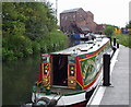
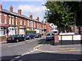
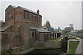
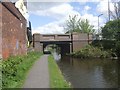

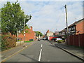
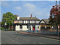
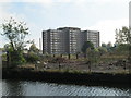
90 photos from this area
Area Information
Key information about the B68 8HH including its size, population, and administrative classification.
- Area Type
- Postcode
- Area Size
- 1.3 hectares
- Population
- 2026
- Population Density
- 8286 people/km²
House Prices in B68 8HH
21
Properties
£161,455
Average Sold Price
£102,000
Lowest Price
£235,000
Highest Price
Showing 21 properties
| Address | Type | Beds | Baths | Last Sale Price | Last Sale Date | |
|---|---|---|---|---|---|---|
| 79 Crosswells Road, Oldbury, B68 8HH | Semi-detached | 3 | 2 | £235,000 | Dec 2020 | |
| 91 Crosswells Road, Oldbury, B68 8HH | Semi-detached | 3 | 1 | £157,000 | Aug 2020 | |
| 92 Crosswells Road, Oldbury, B68 8HH | Semi-detached | 3 | 2 | £165,000 | Nov 2019 | |
| 85 Crosswells Road, Oldbury, B68 8HH | Terraced | 3 | 1 | £140,000 | Nov 2019 | |
| 90 Crosswells Road, Oldbury, B68 8HH | house | 4 | 2 | £202,000 | May 2019 | |
| 73 Crosswells Road, Oldbury, B68 8HH | Semi-detached | - | - | £164,000 | Dec 2007 | |
| 75 Crosswells Road, Oldbury, B68 8HH | Detached | 4 | 1 | £180,000 | Jan 2007 | |
| 71 Crosswells Road, Oldbury, B68 8HH | house | - | - | £164,000 | Sep 2006 | |
| 77 Crosswells Road, Oldbury, B68 8HH | Semi-detached | 4 | 2 | £155,000 | May 2006 | |
| 81 Crosswells Road, Oldbury, B68 8HH | Semi-detached | 3 | 1 | £112,000 | Nov 2005 |
Page 1 of 3
Energy Efficiency in B68 8HH
Amenities
Schools
| Rank | School | Type | Entry gender | Ages |
|---|
Explore more schools in this area
Go to Schools tabDemographics
Household Size
Family (3-5 people)
most common
Accommodation Type
Houses
most common
Tenure
52
majority
Ethnic Group
asian_total
most common
Religion
N/A
most common
Household Composition
N/A
most common
Age
47
median
Adults (30-64 years)
most common
Household Deprivation
N/A
with no deprivation
NS-SEC
14
in Lower managerial occupations
Explore more demographic insights in this area
Go to Demographics tabPlanning
Planning Constraints
- Flood RiskPremium
- Ramsar Wetland SitesPremium
- Area of Outstanding Natural BeautyPremium
- Protected Nature ReservePremium
- Protected WoodlandPremium