Area Overview for B68 8ET
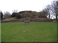
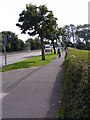
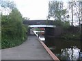
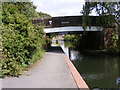
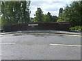
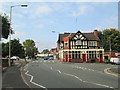
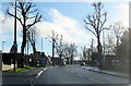
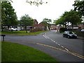
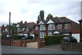
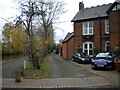
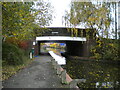
Photos of B68 8ET

Area Information
Living in B68 8ET means being part of a small, tightly knit residential cluster in the West Midlands, centred around Bristnall Fields. With a population of 1,643, the area blends historical roots with modern convenience. Bristnall Ward, which includes this postcode, lies within Oldbury Town, a locale with a long-standing connection to the Dudley family and a heritage tied to Halesowen’s ancient parish. The community is defined by its proximity to key routes like Pound Road and Brandhall Road, where local amenities such as the Plough Inn, Brandhall Allotments, and Oldbury Academy create a sense of everyday practicality. While the area is compact, it benefits from nearby transport links and a mix of retail and leisure options. The median age of 47 suggests a stable, mature population, with many residents likely to have lived in the area for years. For buyers, B68 8ET offers a quiet, established environment with a focus on family-friendly infrastructure and accessible services.
- Area Type
- Postcode
- Area Size
- Not available
- Population
- 1643
- Population Density
- 5792 people/km²
The property market in B68 8ET is dominated by owner-occupied homes, with 64% of residents living in properties they own. This high ownership rate suggests a stable, mature market where properties are less likely to be vacant or subject to frequent turnover. The accommodation type is predominantly houses, which are typically larger and more suited to families. Given the area’s small size, the housing stock is limited, and buyers may need to consider nearby postcodes for a broader selection. The focus on houses rather than flats or apartments indicates a community prioritising space and privacy. For those seeking investment, the market’s stability and low flood risk make it an attractive option, though the medium crime risk score of 51 should be factored into any decision.
House Prices in B68 8ET
No properties found in this postcode.
Energy Efficiency in B68 8ET
Life in B68 8ET is shaped by its proximity to a range of amenities. Within walking or short driving distance are retail outlets like Tesco Birmingham, Asda Oldbury, and Aldi Langley, offering everyday shopping needs. The area’s rail and metro stations—Langley Green, Rowley Regis, and Kenrick Park—provide easy access to larger towns and cities. Locally, the Plough Inn offers a traditional pub experience, while Brandhall Allotments provide green space for gardening. Oldbury Academy serves the community’s educational needs, and the Salvation Army Church and Community Centre on Pound Road adds to the area’s social fabric. These amenities create a balance between convenience and community, making daily life practical and connected.
Amenities
Schools
| Rank | School | Type | Entry gender | Ages |
|---|
Explore more schools in this area
Go to Schools tabDemographics
The population of B68 8ET is predominantly adults aged 30–64, with a median age of 47. This suggests a community with a strong presence of middle-aged residents, many of whom may be in their peak working years. Home ownership is high at 64%, indicating a stable housing market where most residents own their properties. The area is characterised by houses rather than flats or apartments, reflecting a traditional, family-oriented living environment. The predominant ethnic group is White, with no specific data provided on other demographics. This age profile and ownership pattern suggest a community focused on long-term residency, with limited turnover. The absence of detailed diversity statistics means the area’s cultural makeup remains largely unexplored in the data. For buyers, this profile implies a predictable market with homes likely to remain in the same hands for extended periods.
Household Size
Accommodation Type
Tenure
Ethnic Group
Religion
Household Composition
Age
Household Deprivation
NS-SEC
Explore more demographic insights in this area
Go to Demographics tabPlanning
Planning Constraints
- Flood RiskPremium
- Ramsar Wetland SitesPremium
- Area of Outstanding Natural BeautyPremium
- Protected Nature ReservePremium
- Protected WoodlandPremium