Area Overview for B68 0WG
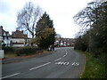
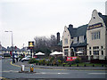
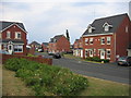
Photos of B68 0WG

Area Information
B68 0WG is a small residential postcode area in the West Midlands, nestled within the Oldbury district of Sandwell. With a population of 1,846, it reflects a tight-knit community shaped by its historical ties to the former Warley region. The area’s compact size means it is closely linked to nearby towns like Rowley Regis and Smethwick, yet it retains a distinct local identity. Daily life here is defined by proximity to essential services and transport links, with a focus on practical living. The area’s demographics suggest a mature population, with a median age of 47 and a majority of residents aged 30–64. This age group likely contributes to the area’s stable, family-oriented character. While no major landmarks or attractions are explicitly listed, the area’s integration into Sandwell’s infrastructure ensures access to broader regional amenities. For those considering homes in B68 0WG, the combination of low crime risk, strong broadband connectivity, and nearby schools makes it a viable option for those prioritising safety and convenience.
- Area Type
- Postcode
- Area Size
- Not available
- Population
- 1846
- Population Density
- 5421 people/km²
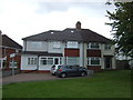
The property market in B68 0WG is characterised by a high rate of home ownership (73%) and a predominance of houses over flats or apartments. This suggests a community where private, standalone homes are the norm, likely catering to families or individuals seeking space and stability. The absence of rental data implies that the area may not be a hotspot for short-term lets or student housing, which could appeal to buyers looking for long-term investment opportunities. Given the small size of the postcode area, property availability is likely limited, making it a niche market for those specifically targeting this region. The focus on houses may also mean that buyers should consider proximity to amenities, as the area’s compact nature could limit access to larger retail or leisure facilities. For those prioritising ownership over rental flexibility, B68 0WG offers a straightforward, low-risk option.
House Prices in B68 0WG
No properties found in this postcode.
Energy Efficiency in B68 0WG
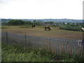
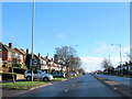
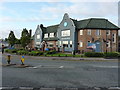
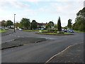
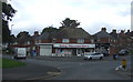
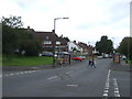
The lifestyle in B68 0WG is shaped by its proximity to essential amenities, including retail outlets such as Heron Oldbury, Co-op Brandhall, and Tesco Birmingham. These shops provide access to everyday goods, reducing the need for long commutes to larger towns. The area’s rail and metro connections also enable residents to explore wider leisure opportunities in nearby cities. While specific parks or recreational facilities are not listed, the lack of environmental constraints like protected woodlands or AONB designations suggests open space may be available for local use. The presence of multiple retail and transport hubs indicates a practical, community-focused lifestyle, where daily needs are met without excessive travel. This balance of convenience and connectivity makes B68 0WG suitable for those valuing accessibility over expansive leisure options.
Amenities
Schools
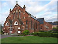
The nearest school to B68 0WG is St Hubert’s Catholic Primary School, which serves the local community with primary education. No secondary schools are listed in the data, so families requiring secondary-level education may need to look beyond the immediate area. The presence of a primary school indicates that the area is suitable for young families, though parents should consider commuting options for older children. The school’s type—Catholic—may align with specific religious preferences, but the lack of additional schools suggests a limited educational ecosystem. For those prioritising a school within walking distance, St Hubert’s provides a foundational resource, though broader educational needs may require planning for nearby institutions.
| Rank | School | Type | Entry gender | Ages |
|---|
Explore more schools in this area
Go to Schools tabDemographics
The population of B68 0WG is 1,846, with a median age of 47, indicating a community skewed towards middle-aged adults. Over 73% of residents own their homes, a figure that suggests a stable housing market with limited rental activity. The predominant accommodation type is houses, reflecting a residential area that likely prioritises private, family-oriented living spaces. The most common age range, 30–64 years, aligns with a demographic that may be focused on long-term residence rather than transient living. The predominant ethnic group is White, which, combined with the absence of specific diversity data, suggests a homogenous population. This profile may influence the area’s social dynamics and community cohesion. With no data on deprivation levels, it is difficult to assess socioeconomic challenges, but the high home ownership rate and low crime score imply a relatively secure environment for residents.
Household Size
Accommodation Type
Tenure
Ethnic Group
Religion
Household Composition
Age
Household Deprivation
NS-SEC
Explore more demographic insights in this area
Go to Demographics tabPlanning
Planning Constraints
- Flood RiskPremium
- Ramsar Wetland SitesPremium
- Area of Outstanding Natural BeautyPremium
- Protected Nature ReservePremium
- Protected WoodlandPremium