Area Overview for B68 0RN
Photos of B68 0RN

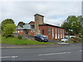
19 photos from this area
Area Information
Key information about the B68 0RN including its size, population, and administrative classification.
- Area Type
- Postcode
- Area Size
- 4145 m²
- Population
- 1586
- Population Density
- 8269 people/km²
House Prices in B68 0RN
8
Properties
£110,286
Average Sold Price
£54,000
Lowest Price
£230,000
Highest Price
Showing 8 properties
| Address | Type | Beds | Baths | Last Sale Price | Last Sale Date | |
|---|---|---|---|---|---|---|
| 105 Oldacre Road, Oldbury, B68 0RN | house | 2 | - | £230,000 | May 2022 | |
| 97 Oldacre Road, Oldbury, B68 0RN | Semi-detached | 3 | 1 | £140,000 | Feb 2021 | |
| 109 Oldacre Road, Oldbury, B68 0RN | Semi-detached | 2 | 1 | £65,000 | Jul 2019 | |
| 111 Oldacre Road, Oldbury, B68 0RN | Bungalow | 2 | - | £54,000 | Jun 2014 | |
| 99 Oldacre Road, Oldbury, B68 0RN | house | - | - | £123,000 | Jun 2011 | |
| 103 Oldacre Road, Oldbury, B68 0RN | house | 2 | 1 | £90,000 | Oct 2009 | |
| 107 Oldacre Road, Oldbury, B68 0RN | house | - | - | £70,000 | Sep 2002 | |
| 101 Oldacre Road, Oldbury, B68 0RN | house | - | - | - | - |
Energy Efficiency in B68 0RN
Amenities
Schools
| Rank | School | Type | Entry gender | Ages |
|---|
Explore more schools in this area
Go to Schools tabDemographics
Household Size
Family (3-5 people)
most common
Accommodation Type
Houses
most common
Tenure
52
majority
Ethnic Group
White
most common
Religion
N/A
most common
Household Composition
N/A
most common
Age
47
median
Adults (30-64 years)
most common
Household Deprivation
N/A
with no deprivation
NS-SEC
21
in Lower managerial occupations
Explore more demographic insights in this area
Go to Demographics tabPlanning
Planning Constraints
- Flood RiskPremium
- Ramsar Wetland SitesPremium
- Area of Outstanding Natural BeautyPremium
- Protected Nature ReservePremium
- Protected WoodlandPremium