Area Overview for B68 0RH
Photos of B68 0RH
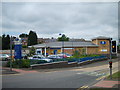
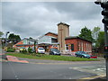
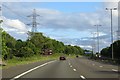
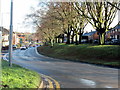

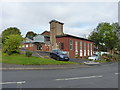

19 photos from this area
Area Information
Key information about the B68 0RH including its size, population, and administrative classification.
- Area Type
- Postcode
- Area Size
- 6985 m²
- Population
- 1736
- Population Density
- 2513 people/km²
House Prices in B68 0RH
22
Properties
£104,445
Average Sold Price
£37,950
Lowest Price
£235,000
Highest Price
Showing 22 properties
| Address | Type | Beds | Baths | Last Sale Price | Last Sale Date | |
|---|---|---|---|---|---|---|
| 7 Pitfields Road, Oldbury, B68 0RH | Semi-detached | 3 | 1 | £235,000 | Apr 2025 | |
| 29 Pitfields Road, Oldbury, B68 0RH | house | - | - | £150,000 | May 2021 | |
| 43 Pitfields Road, Oldbury, B68 0RH | house | - | - | £120,000 | Apr 2019 | |
| 21 Pitfields Road, Oldbury, B68 0RH | Semi-detached | 3 | - | £117,500 | Aug 2014 | |
| 3 Pitfields Road, Oldbury, B68 0RH | Semi-detached | 3 | 1 | £116,000 | Jun 2013 | |
| 23 Pitfields Road, Oldbury, B68 0RH | house | - | - | £117,000 | Nov 2008 | |
| 11 Pitfields Road, Oldbury, B68 0RH | Semi-detached | - | - | £60,000 | Jul 2001 | |
| 25 Pitfields Road, Oldbury, B68 0RH | Semi-detached | 3 | 1 | £46,000 | May 1998 | |
| 15 Pitfields Road, Oldbury, B68 0RH | Semi-detached | - | - | £37,950 | Jun 1996 | |
| 31 Pitfields Road, Oldbury, B68 0RH | house | - | - | £45,000 | Dec 1995 |
Page 1 of 3
Energy Efficiency in B68 0RH
Amenities
Schools
| Rank | School | Type | Entry gender | Ages |
|---|
Explore more schools in this area
Go to Schools tabDemographics
Household Size
One person
most common
Accommodation Type
Houses
most common
Tenure
51
majority
Ethnic Group
White
most common
Religion
N/A
most common
Household Composition
N/A
most common
Age
47
median
Adults (30-64 years)
most common
Household Deprivation
N/A
with no deprivation
NS-SEC
20
in Lower managerial occupations
Explore more demographic insights in this area
Go to Demographics tabPlanning
Planning Constraints
- Flood RiskPremium
- Ramsar Wetland SitesPremium
- Area of Outstanding Natural BeautyPremium
- Protected Nature ReservePremium
- Protected WoodlandPremium