Area Overview for B68 0PZ
Photos of B68 0PZ
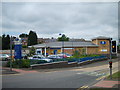
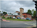
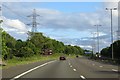
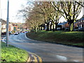

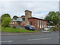
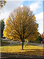

19 photos from this area
Area Information
Key information about the B68 0PZ including its size, population, and administrative classification.
- Area Type
- Postcode
- Area Size
- 9913 m²
- Population
- 1575
- Population Density
- 4000 people/km²
House Prices in B68 0PZ
32
Properties
£149,350
Average Sold Price
£59,995
Lowest Price
£265,000
Highest Price
Showing 32 properties
| Address | Type | Beds | Baths | Last Sale Price | Last Sale Date | |
|---|---|---|---|---|---|---|
| 38 Kingsway, Oldbury, B68 0PZ | Detached | 3 | 2 | £175,000 | May 2025 | |
| 44 Kingsway, Oldbury, B68 0PZ | Detached | 3 | 1 | £207,000 | Mar 2025 | |
| 60 Kingsway, Oldbury, B68 0PZ | Semi-detached | 3 | 1 | £265,000 | Mar 2025 | |
| 68 Kingsway, Oldbury, B68 0PZ | Semi-detached | 4 | 2 | £165,000 | Aug 2024 | |
| 52 Kingsway, Oldbury, B68 0PZ | Semi-detached | 3 | 1 | £205,000 | May 2022 | |
| 76 Kingsway, Oldbury, B68 0PZ | Semi-detached | 3 | - | £218,000 | Aug 2021 | |
| 72 Kingsway, Oldbury, B68 0PZ | Semi-detached | 3 | 1 | £156,000 | Oct 2018 | |
| 48 Kingsway, Oldbury, B68 0PZ | Semi-detached | 3 | 1 | £115,000 | Jul 2018 | |
| 74 Kingsway, Oldbury, B68 0PZ | Semi-detached | 3 | 1 | £193,000 | Jan 2018 | |
| 32 Kingsway, Oldbury, B68 0PZ | house | - | - | £202,500 | Sep 2017 |
Page 1 of 4
Energy Efficiency in B68 0PZ
Amenities
Schools
| Rank | School | Type | Entry gender | Ages |
|---|
Explore more schools in this area
Go to Schools tabDemographics
Household Size
Family (3-5 people)
most common
Accommodation Type
Houses
most common
Tenure
85
majority
Ethnic Group
White
most common
Religion
N/A
most common
Household Composition
N/A
most common
Age
47
median
Adults (30-64 years)
most common
Household Deprivation
N/A
with no deprivation
NS-SEC
32
in Lower managerial occupations
Explore more demographic insights in this area
Go to Demographics tabPlanning
Planning Constraints
- Flood RiskPremium
- Ramsar Wetland SitesPremium
- Area of Outstanding Natural BeautyPremium
- Protected Nature ReservePremium
- Protected WoodlandPremium