Area Overview for B68 0LN
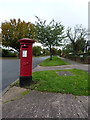
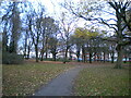
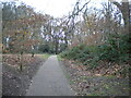
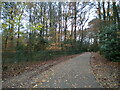
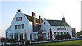
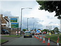
Photos of B68 0LN


Area Information
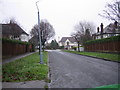
Living in B68 0LN offers a snapshot of suburban stability in the West Midlands. This small residential cluster, part of Old Warley Ward in Sandwell, is home to 1,619 people, with a population density suggesting a tight-knit community. The area’s history is rooted in the ancient Manor of Warley, now integrated into modern Sandwell. Daily life here is defined by proximity to local amenities, with a mix of retail, transport, and green spaces. The postcode sits near the historic boundary of Oldbury, blending residential tranquillity with practical connectivity. Residents benefit from nearby railway stations and a broadband score of 100, ensuring reliable digital access. While the area lacks major landmarks or cultural hubs, its low crime risk and absence of environmental constraints make it appealing for families seeking a balanced lifestyle. The predominance of owner-occupied homes and a median age of 47 suggest a mature, settled demographic. For those prioritising safety, convenience, and a manageable pace of life, B68 0LN presents a straightforward proposition.
- Area Type
- Postcode
- Area Size
- Not available
- Population
- 1619
- Population Density
- 4678 people/km²
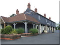
The property market in B68 0LN is characterised by high home ownership (82%) and a focus on detached or semi-detached houses. This suggests a low-rise, suburban environment where owner-occupation is the norm, rather than a rental market. The absence of flats or apartments indicates limited high-density development, which may appeal to buyers seeking spacious, traditional homes. The small size of the area means property choices are limited to the immediate vicinity, with little scope for expansion. For buyers, this translates to a stable market with fewer speculative risks, though competition may be fierce due to the area’s appeal. The predominance of houses also implies higher maintenance costs and larger land areas, which could be a consideration for those prioritising affordability. Overall, B68 0LN suits those seeking a settled, family-friendly environment with minimal rental activity.
House Prices in B68 0LN
No properties found in this postcode.
Energy Efficiency in B68 0LN
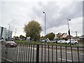
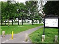
The lifestyle in B68 0LN is defined by local retail, transport, and proximity to green spaces. Nearby shops include Co-op Hagley, Co-op Harborne, and Heron Oldbury, offering essentials and groceries. The five railway stations and three metro stops provide easy access to Birmingham and surrounding areas, supporting both daily commutes and weekend travel. While the data does not list parks or leisure facilities explicitly, the absence of planning constraints like protected woodlands or AONB status suggests open spaces may exist nearby. The area’s low crime risk and practical amenities make it suitable for families, though cultural or entertainment options are limited to the immediate vicinity. The mix of retail and transport options ensures daily life is functional, with a focus on convenience over luxury. Residents benefit from a straightforward, no-frills lifestyle.
Amenities
Schools
Residents of B68 0LN have access to two primary schools: Lightwoods Primary School and Lightwoods Primary Academy. Both are primary institutions, with the latter holding an Ofsted rating of ‘good’. The presence of two primary schools within proximity offers families options for early education, though secondary schooling is not listed in the data. The mix of schools suggests a focus on foundational education, which may be sufficient for younger children but could require commuting for older students. For families prioritising primary education, the ‘good’ rating at Lightwoods Primary Academy indicates a reliable standard of teaching. However, the absence of secondary schools nearby means parents should consider transport links to larger towns for secondary education. The schools’ proximity to homes reinforces the area’s appeal for families.
| Rank | School | Type | Entry gender | Ages |
|---|
Explore more schools in this area
Go to Schools tabDemographics
The community in B68 0LN is predominantly composed of adults aged 30–64, with a median age of 47. This suggests a mature population, likely with established careers and families. Home ownership is high at 82%, indicating a strong preference for long-term residency over rental properties. The accommodation type is exclusively houses, reflecting a suburban rather than urban layout. The predominant ethnic group is White, though specific diversity metrics are not provided. The low deprivation levels implied by the data align with the area’s safety and infrastructure. For quality of life, the age profile suggests a stable demographic with fewer young dependents or elderly residents, which may influence local services and amenities. The absence of detailed diversity statistics means the community’s cultural composition remains less defined, but the data underscores a cohesive, middle-aged population with a focus on home ownership.
Household Size
Accommodation Type
Tenure
Ethnic Group
Religion
Household Composition
Age
Household Deprivation
NS-SEC
Explore more demographic insights in this area
Go to Demographics tabPlanning
Planning Constraints
- Flood RiskPremium
- Ramsar Wetland SitesPremium
- Area of Outstanding Natural BeautyPremium
- Protected Nature ReservePremium
- Protected WoodlandPremium