Area Overview for B68 0LL
Photos of B68 0LL
Area Information
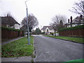
Living in B68 0LL means being part of a small, tightly knit residential cluster in the West Midlands, with a population of 1,619. This area, historically part of the Warley district, is now integrated into Sandwell, offering a blend of suburban calm and proximity to larger urban centres. The community is predominantly middle-aged, with a median age of 47, and most residents are adults aged 30–64. Home ownership is high at 82%, reflecting a stable, long-term presence. The area’s character is defined by its housing stock, which is largely composed of houses rather than flats, creating a quieter, more private living environment. Nearby, Lightwoods Primary School and Lightwoods Primary Academy provide education options, while rail and metro stations offer easy access to surrounding towns. Daily life here balances local amenities with the convenience of nearby connectivity, making it appealing for those seeking a settled, family-friendly environment without sacrificing accessibility.
- Area Type
- Postcode
- Area Size
- Not available
- Population
- 1619
- Population Density
- 4678 people/km²
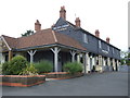
The property market in B68 0LL is characterised by high home ownership (82%) and a predominance of houses. This suggests a community where long-term residency is common, with fewer rental properties available. The small population of 1,619 means the housing stock is limited, creating a tight local market. Buyers should consider that the area’s small size means property choices are constrained, but the focus on houses may appeal to those seeking private, family-oriented homes. Proximity to rail and metro stations, along with nearby schools, adds to the area’s desirability for families. However, the limited scale of the area means buyers must balance proximity to amenities with the availability of suitable properties. The market likely reflects a mix of older, established homes rather than new developments, offering a distinct character that aligns with the area’s historical roots.
House Prices in B68 0LL
No properties found in this postcode.
Energy Efficiency in B68 0LL
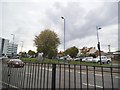
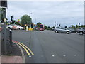
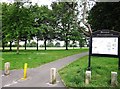
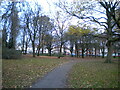
Residents of B68 0LL benefit from a range of nearby amenities, including five retail outlets such as Co-op Hagley and Heron Oldbury, which provide essential shopping options. The area’s rail and metro stations, including Langley Green and Edgbaston Village, offer convenient access to public transport, supporting both daily commutes and leisure travel. While parks and recreational spaces are not explicitly mentioned in the data, the proximity to transport hubs and retail venues suggests a lifestyle that balances local convenience with regional connectivity. The presence of multiple retail options and transport links contributes to a practical, accessible daily life. The small-scale nature of the area means amenities are tightly clustered, reducing the need for long journeys for basic needs. This setup is ideal for those prioritising ease of access over expansive leisure facilities.
Amenities
Schools
Residents of B68 0LL have access to two primary schools: Lightwoods Primary School and Lightwoods Primary Academy. Both institutions serve the local community, though only the latter has an Ofsted rating of ‘good’. The presence of two primary schools within the area provides families with options for their children’s early education, though secondary school choices would need to be sought beyond the immediate vicinity. The mix of school types suggests a focus on foundational education, which is critical for young families. The ‘good’ rating at Lightwoods Primary Academy indicates a standard of teaching and facilities that meets regulatory expectations. However, the absence of secondary schools in the data means parents may need to look further afield for comprehensive education. This dynamic is common in smaller residential areas where primary schooling is prioritised over higher-level institutions.
| Rank | School | Type | Entry gender | Ages |
|---|
Explore more schools in this area
Go to Schools tabDemographics
The population of B68 0LL is 1,619, with a median age of 47. The majority of residents fall within the 30–64 age range, indicating a mature, stable community. Home ownership is high at 82%, suggesting a strong presence of long-term residents. The area is predominantly composed of houses, with no mention of flats or apartments in the data. The predominant ethnic group is White, though no specific diversity statistics are provided. This age profile and ownership rate suggest a community focused on family life and established careers. The absence of detailed deprivation data means the quality of life is inferred from the low crime rate and limited environmental risks. Residents likely value stability, with fewer transient populations compared to other urban areas. The demographic profile aligns with a place where local amenities and services cater to a consistent, middle-aged population.
Household Size
Accommodation Type
Tenure
Ethnic Group
Religion
Household Composition
Age
Household Deprivation
NS-SEC
Explore more demographic insights in this area
Go to Demographics tabPlanning
Planning Constraints
- Flood RiskPremium
- Ramsar Wetland SitesPremium
- Area of Outstanding Natural BeautyPremium
- Protected Nature ReservePremium
- Protected WoodlandPremium