Area Overview for B68 0ED
Photos of B68 0ED
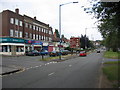
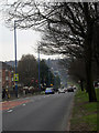
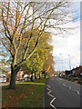
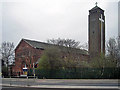
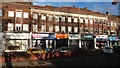
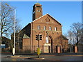
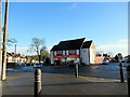
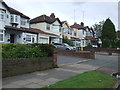
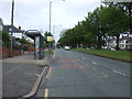
25 photos from this area
Area Information
Key information about the B68 0ED including its size, population, and administrative classification.
- Area Type
- Postcode
- Area Size
- 1.5 hectares
- Population
- 1829
- Population Density
- 5910 people/km²
House Prices in B68 0ED
39
Properties
£202,277
Average Sold Price
£79,000
Lowest Price
£420,000
Highest Price
Showing 39 properties
| Address | Type | Beds | Baths | Last Sale Price | Last Sale Date | |
|---|---|---|---|---|---|---|
| 97 Forest Road, Oldbury, B68 0ED | Terraced | 3 | 1 | £275,000 | May 2024 | |
| 99 Forest Road, Oldbury, B68 0ED | Semi-detached | 4 | 2 | £400,000 | Oct 2023 | |
| 93 Forest Road, Oldbury, B68 0ED | Semi-detached | 4 | 2 | £300,000 | Nov 2022 | |
| 101 Forest Road, Oldbury, B68 0ED | Bungalow | - | - | £420,000 | Jan 2022 | |
| 43 Forest Road, Oldbury, B68 0ED | house | - | - | £230,000 | Nov 2019 | |
| 91 Forest Road, Oldbury, B68 0ED | Semi-detached | 3 | 1 | £232,000 | Jul 2019 | |
| 95 Forest Road, Oldbury, B68 0ED | house | - | - | £242,500 | Dec 2018 | |
| 75 Forest Road, Oldbury, B68 0ED | Semi-detached | 4 | 1 | £230,000 | Jun 2018 | |
| 35 Forest Road, Oldbury, B68 0ED | house | 3 | 1 | £225,000 | Aug 2017 | |
| 51 Forest Road, Oldbury, B68 0ED | Semi-detached | 3 | 4 | £172,500 | Dec 2016 |
Page 1 of 4
Energy Efficiency in B68 0ED
Amenities
Schools
| Rank | School | Type | Entry gender | Ages |
|---|
Explore more schools in this area
Go to Schools tabDemographics
Household Size
Family (3-5 people)
most common
Accommodation Type
Houses
most common
Tenure
71
majority
Ethnic Group
White
most common
Religion
N/A
most common
Household Composition
N/A
most common
Age
47
median
Adults (30-64 years)
most common
Household Deprivation
N/A
with no deprivation
NS-SEC
31
in Lower managerial occupations
Explore more demographic insights in this area
Go to Demographics tabPlanning
Planning Constraints
- Flood RiskPremium
- Ramsar Wetland SitesPremium
- Area of Outstanding Natural BeautyPremium
- Protected Nature ReservePremium
- Protected WoodlandPremium