Area Overview for B68 0DX
Photos of B68 0DX


Area Information
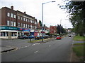
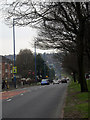
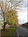
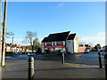
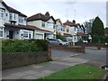
Living in B68 0DX offers a quiet, residential lifestyle within the Oldbury area of Sandwell, West Midlands. With a population of 1,585, this small postcode area is part of the historically significant Warley district, now integrated into Sandwell. The community here is characterised by a mature demographic, with a median age of 47 and most residents falling within the 30–64 age range. The area’s compact size means it is well-served by local amenities, including five retail outlets such as Co-op Hagley and Tesco Quinton. Proximity to rail networks, including Rowley Regis and Langley Green stations, ensures easy access to nearby cities. While the area lacks natural beauty designations, its low flood risk and below-average crime rate contribute to a sense of stability. B68 0DX is ideal for those seeking a settled, low-maintenance environment with strong community ties and practical connectivity.
- Area Type
- Postcode
- Area Size
- Not available
- Population
- 1585
- Population Density
- 6477 people/km²
The property market in B68 0DX is dominated by owner-occupied homes, with 82% of residents living in properties they own. This contrasts with areas where rental markets are more prevalent, suggesting a community of long-term residents rather than transient tenants. The accommodation type is exclusively houses, not flats or apartments, which may appeal to families seeking more space and privacy. Given the small size of the postcode area, the housing stock is limited, meaning properties here are likely to be in high demand. Buyers should consider the area’s compact nature, as nearby developments may offer more options. The emphasis on owner-occupation also indicates strong local ties, with residents less likely to move frequently. For those prioritising stability and a traditional housing layout, B68 0DX presents a focused, if limited, market.
House Prices in B68 0DX
No properties found in this postcode.
Energy Efficiency in B68 0DX
Daily life in B68 0DX is shaped by its proximity to practical amenities. Local shops like Co-op Hagley, Tesco Quinton, and Co-op Brandhall provide essential retail services, while nearby rail and metro stations connect residents to broader networks. The area’s small size means amenities are within walking or short driving distance, fostering a convenient lifestyle. Though there are no named parks or leisure facilities in the data, the rail links to areas like Handsworth Booth Street suggest access to cultural or recreational hubs. The mix of retail and transport options supports both routine needs and occasional outings. This balance of local convenience and regional connectivity makes B68 0DX suitable for those who value accessibility without the hustle of a dense urban environment.
Amenities
Schools
| Rank | School | Type | Entry gender | Ages |
|---|
Explore more schools in this area
Go to Schools tabDemographics
The population of B68 0DX is 1,585, with a median age of 47, indicating a mature community. Most residents are adults aged 30–64, reflecting a stable, family-oriented demographic. Home ownership is high, with 82% of households owning their homes, suggesting a long-term presence of residents. The area is predominantly composed of houses, not flats, which aligns with the age profile of older, established families. The predominant ethnic group is White, though specific data on diversity or deprivation is not provided. This demographic profile implies a community focused on stability and continuity, with limited turnover of residents. The absence of detailed diversity statistics means the area’s cultural makeup remains less defined in the data, but the high home ownership rate and age distribution point to a cohesive, long-standing local population.
Household Size
Accommodation Type
Tenure
Ethnic Group
Religion
Household Composition
Age
Household Deprivation
NS-SEC
Explore more demographic insights in this area
Go to Demographics tabPlanning
Planning Constraints
- Flood RiskPremium
- Ramsar Wetland SitesPremium
- Area of Outstanding Natural BeautyPremium
- Protected Nature ReservePremium
- Protected WoodlandPremium