Area Overview for B68 0DB
Photos of B68 0DB
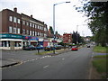
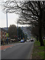
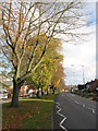
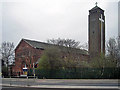
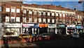
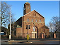
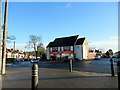
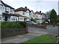
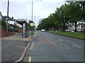
25 photos from this area
Area Information
Key information about the B68 0DB including its size, population, and administrative classification.
- Area Type
- Postcode
- Area Size
- 9919 m²
- Population
- 1829
- Population Density
- 5910 people/km²
House Prices in B68 0DB
33
Properties
£127,241
Average Sold Price
£28,400
Lowest Price
£310,000
Highest Price
Showing 33 properties
| Address | Type | Beds | Baths | Last Sale Price | Last Sale Date | |
|---|---|---|---|---|---|---|
| 37 Sunnybank Road, Oldbury, B68 0DB | Semi-detached | 3 | 1 | £270,000 | Jul 2024 | |
| 39 Sunnybank Road, Oldbury, B68 0DB | Flat | - | - | £28,400 | Apr 2022 | |
| 67 Sunnybank Road, Oldbury, B68 0DB | Flat | - | - | £135,000 | Sep 2021 | |
| 49 Sunnybank Road, Oldbury, B68 0DB | Flat | - | - | £125,000 | Jun 2021 | |
| 69 Sunnybank Road, Oldbury, B68 0DB | Maisonette | - | - | £73,700 | Jun 2020 | |
| 35 Sunnybank Road, Oldbury, B68 0DB | house | 3 | 1 | £216,500 | Dec 2019 | |
| 41 Sunnybank Road, Oldbury, B68 0DB | Flat | 3 | 1 | £104,000 | Apr 2018 | |
| 7 Sunnybank Road, Oldbury, B68 0DB | Semi-detached | 3 | 1 | £171,000 | Apr 2016 | |
| 33 Sunnybank Road, Oldbury, B68 0DB | Detached | 3 | 1 | £141,000 | Jun 2015 | |
| 25 Sunnybank Road, Oldbury, B68 0DB | house | - | - | £120,000 | Jun 2015 |
Page 1 of 4
Energy Efficiency in B68 0DB
Amenities
Schools
| Rank | School | Type | Entry gender | Ages |
|---|
Explore more schools in this area
Go to Schools tabDemographics
Household Size
Family (3-5 people)
most common
Accommodation Type
Houses
most common
Tenure
71
majority
Ethnic Group
White
most common
Religion
N/A
most common
Household Composition
N/A
most common
Age
47
median
Adults (30-64 years)
most common
Household Deprivation
N/A
with no deprivation
NS-SEC
31
in Lower managerial occupations
Explore more demographic insights in this area
Go to Demographics tabPlanning
Planning Constraints
- Flood RiskPremium
- Ramsar Wetland SitesPremium
- Area of Outstanding Natural BeautyPremium
- Protected Nature ReservePremium
- Protected WoodlandPremium