Area Overview for B67 9JA
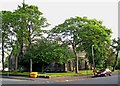
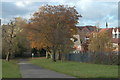
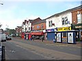
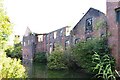
Photos of B67 9JA


Area Information
Living in B67 9JA means being part of a compact, residential cluster in England’s West Midlands, where the population of 2,077 reflects a tight-knit community. This area, historically rooted in Smethwick’s industrial past, sits 4 miles west of Birmingham city centre, blending urban convenience with traces of its heritage as a former Staffordshire and Worcestershire hamlet. Daily life here is shaped by proximity to transport hubs, including five railway stations such as Smethwick Rolfe Street and Hawthorns, and retail options like Asda Cape and Iceland Smethwick. The area’s demographic profile—skewed toward adults aged 30–64, with a significant Asian population—suggests a mature, stable community. While the small population means a close-knit social fabric, residents benefit from access to schools like Crocketts Community Primary School, rated outstanding by Ofsted, and a mix of special educational provisions. The area’s compact size ensures amenities are within practical reach, though its limited scale means it’s best suited for those prioritising connectivity over sprawling suburban sprawl.
- Area Type
- Postcode
- Area Size
- Not available
- Population
- 2077
- Population Density
- 6252 people/km²
The property market in B67 9JA is characterised by a low home ownership rate of 24%, indicating that the majority of residents rent rather than own their homes. This suggests a rental market dominated by private landlords or housing associations, which may influence property availability and affordability. The accommodation type is primarily houses, a rarity in contemporary urban areas, implying a stock of older, possibly larger properties. Given the area’s small size, the housing stock is likely limited, with little scope for new developments. For buyers, this means competition may be fierce, and properties are likely to be older, requiring maintenance. The prevalence of houses over flats or apartments may appeal to those seeking space, but buyers should consider the limited supply and potential for higher prices relative to the area’s modest scale.
House Prices in B67 9JA
No properties found in this postcode.
Energy Efficiency in B67 9JA
The lifestyle in B67 9JA is shaped by its proximity to practical amenities, including five retail outlets such as Asda Cape and Iceland Smethwick, offering everyday shopping needs. The area’s rail and metro stations, including Smethwick Galton Bridge and Handsworth Booth Street, provide easy access to public transport, reducing the need for private vehicles. While parks and leisure facilities are not explicitly listed, the historical industrial landscape of Smethwick suggests potential for green spaces near former sites like the Soho Foundry. The presence of multiple railway stations and retail hubs indicates a community focused on convenience, with amenities clustered for easy access. This setup supports a lifestyle where daily errands and commuting are streamlined, though residents may need to travel further for larger leisure or cultural offerings.
Amenities
Schools
Residents of B67 9JA have access to a range of educational institutions, including Crocketts Community Primary School, which is rated outstanding by Ofsted. This primary school provides a high standard of education for younger children, a key consideration for families. Nearby, Arden School and Firs School cater to special educational needs, offering tailored support for students with specific requirements. The presence of both mainstream and special schools reflects the area’s diverse population and ensures that children of all abilities have access to appropriate learning environments. For parents, this mix of school types means a choice between general education and specialised support, though the limited number of schools may mean longer commutes for those seeking options beyond the immediate vicinity.
| Rank | School | Type | Entry gender | Ages |
|---|
Explore more schools in this area
Go to Schools tabDemographics
B67 9JA’s population of 2,077 is predominantly composed of adults aged 30–64, with a median age of 47. This suggests a community of established professionals and families, rather than a younger or elderly demographic. Home ownership here is notably low at 24%, indicating a rental-heavy market, which may reflect the area’s history as a working-class hub. The accommodation type is primarily houses, a rarity in modern UK urban areas, pointing to older, possibly period properties. The predominant ethnic group is Asian, highlighting cultural diversity. While deprivation data is not provided, the combination of low home ownership and a mature age profile may imply a community with mixed economic stability. The presence of special schools like Arden and Firs School suggests a need for tailored educational support, aligning with the area’s demographic makeup.
Household Size
Accommodation Type
Tenure
Ethnic Group
Religion
Household Composition
Age
Household Deprivation
NS-SEC
Explore more demographic insights in this area
Go to Demographics tabPlanning
Planning Constraints
- Flood RiskPremium
- Ramsar Wetland SitesPremium
- Area of Outstanding Natural BeautyPremium
- Protected Nature ReservePremium
- Protected WoodlandPremium