Area Overview for B67 7JB
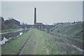
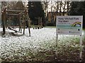
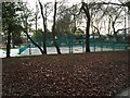
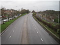
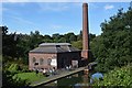
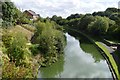
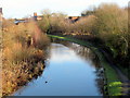
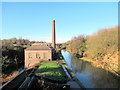
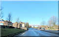
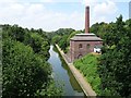
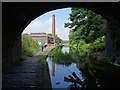
Photos of B67 7JB
Area Information
Living in B67 7JB means inhabiting a compact, densely populated postcode area of 2.6 hectares, home to 2,150 residents. The area’s small size and high population density of 83,622 people per square kilometre reflect a tightly knit community, though space is limited. Historically, this part of the West Midlands was shaped by industrial activity, with connections to the Black Country’s glassworks and manufacturing heritage. Today, the area balances its past with modern living, offering proximity to rail networks and retail hubs. Residents benefit from five nearby railway stations, including Smethwick Galton Bridge High Level and Langley Green, providing regular links to Birmingham and beyond. Daily life here is characterised by a mix of practicality and accessibility, with essential amenities within walking distance. The presence of schools like Leasowes Primary and Holly Lodge High School ensures families have options, while the predominantly Asian population contributes to a culturally distinct community. Despite its small footprint, B67 7JB offers a blend of historical roots and contemporary convenience, though its density may influence the pace of life.
- Area Type
- Postcode
- Area Size
- 2.6 hectares
- Population
- 2150
- Population Density
- 2184 people/km²
The property market in B67 7JB is defined by a 55% home ownership rate, with houses forming the primary accommodation type. This suggests a focus on owner-occupied properties rather than a rental-dominated market, though the exact proportion of rental homes is unspecified. Given the area’s small size—just 2.6 hectares—housing stock is limited, which may create competition among buyers and renters. The dominance of houses over flats or apartments indicates a preference for larger, possibly family-oriented dwellings. However, the high population density of 83,622 people per square kilometre raises questions about spatial constraints, potentially limiting new developments. For buyers, this small area’s proximity to transport links and amenities could be a draw, but the limited housing stock may mean fewer choices. The market likely caters to those seeking stability in a compact, established community, though the lack of detailed data on property types or prices means potential buyers must consider local listings carefully.
House Prices in B67 7JB
No properties found in this postcode.
Energy Efficiency in B67 7JB
Life in B67 7JB is shaped by its proximity to essential amenities, including five retail outlets like Farmfoods West and Asda Cape, which cater to everyday shopping needs. The area’s rail network, with stations such as Smethwick Galton Bridge and Langley Green, ensures easy access to broader regional hubs. Metro stops at Kenrick Park and West Bromwich Central further enhance mobility, making commuting efficient. While the area lacks large parks or leisure facilities, its compact design means amenities are within walking distance. The presence of schools, retail, and transport links fosters a practical, community-oriented lifestyle. However, the high population density may limit private outdoor space, requiring residents to rely on shared or public areas. The mix of retail and transport options supports a functional daily life, though the small size of the area means choices are concentrated within a tight radius.
Amenities
Schools
Residents of B67 7JB have access to a range of educational institutions, including Ruskin House Pupil Referral Unit, which caters to students with specific needs, and Albert Bradford School, a special needs institution. Leasowes Primary School and West Park College serve younger children, while Holly Lodge High School College of Science is noted for its good Ofsted rating. This mix of school types—primary, special, and pupil referral—offers families diverse options, though the absence of secondary schools with higher ratings may be a consideration. The presence of a Pupil Referral Unit highlights the area’s role in supporting students with complex needs, while the good-rated primary school suggests at least one institution meets quality standards. Families seeking a broader range of educational choices may need to look beyond the immediate vicinity, but the variety of schools reflects an effort to accommodate different learning requirements.
| Rank | School | Type | Entry gender | Ages |
|---|
Explore more schools in this area
Go to Schools tabDemographics
The population of B67 7JB has a median age of 47, with the majority aged between 30 and 64. This suggests a mature, stable community, likely with established careers and family structures. Home ownership stands at 55%, indicating a mix of owner-occupied and rental properties, though the data does not specify the latter’s proportion. The accommodation type is predominantly houses, which may reflect a preference for larger living spaces in a small area. The predominant ethnic group is the Asian community, though exact proportions are not provided. This demographic profile shapes the area’s social fabric, with potential for community cohesion and shared cultural practices. The high population density of 83,622 people per square kilometre implies a compact, possibly urban environment, which may influence local services and infrastructure demands. While no deprivation data is available, the presence of schools, retail, and transport options suggests a functional, if densely packed, quality of life.
Household Size
Accommodation Type
Tenure
Ethnic Group
Religion
Household Composition
Age
Household Deprivation
NS-SEC
Explore more demographic insights in this area
Go to Demographics tabPlanning
Planning Constraints
- Flood RiskPremium
- Ramsar Wetland SitesPremium
- Area of Outstanding Natural BeautyPremium
- Protected Nature ReservePremium
- Protected WoodlandPremium