Area Overview for B67 7HS
Photos of B67 7HS
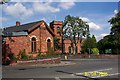
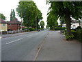
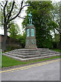


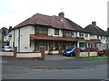
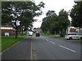


20 photos from this area
Area Information
Key information about the B67 7HS including its size, population, and administrative classification.
- Area Type
- Postcode
- Area Size
- 8658 m²
- Population
- 1423
- Population Density
- 4221 people/km²
House Prices in B67 7HS
33
Properties
£134,590
Average Sold Price
£84,000
Lowest Price
£215,000
Highest Price
Showing 33 properties
| Address | Type | Beds | Baths | Last Sale Price | Last Sale Date | |
|---|---|---|---|---|---|---|
| 40 Shakespeare Road, Smethwick, B67 7HS | Semi-detached | 3 | 1 | £210,000 | May 2022 | |
| 30 Shakespeare Road, Smethwick, B67 7HS | Retail | 3 | 1 | £180,000 | Mar 2022 | |
| 39 Shakespeare Road, Smethwick, B67 7HS | Terraced | 3 | 1 | £135,000 | Apr 2019 | |
| 55 Shakespeare Road, Smethwick, B67 7HS | house | - | - | £135,000 | Feb 2019 | |
| 43 Shakespeare Road, Smethwick, B67 7HS | Terraced | 5 | - | £215,000 | Jul 2015 | |
| 53 Shakespeare Road, Smethwick, B67 7HS | Terraced | 3 | - | £88,000 | Jun 2013 | |
| 27 Shakespeare Road, Smethwick, B67 7HS | house | 3 | - | £110,000 | Dec 2012 | |
| 47 Shakespeare Road, Smethwick, B67 7HS | house | 3 | - | £100,000 | Aug 2010 | |
| 35 Shakespeare Road, Smethwick, B67 7HS | house | 3 | - | £124,995 | Nov 2006 | |
| 22 Shakespeare Road, Smethwick, B67 7HS | Terraced | - | - | £84,000 | Aug 2006 |
Page 1 of 4
Energy Efficiency in B67 7HS
Amenities
Schools
| Rank | School | Type | Entry gender | Ages |
|---|
Explore more schools in this area
Go to Schools tabDemographics
Household Size
Family (3-5 people)
most common
Accommodation Type
Houses
most common
Tenure
54
majority
Ethnic Group
asian_total
most common
Religion
N/A
most common
Household Composition
N/A
most common
Age
47
median
Adults (30-64 years)
most common
Household Deprivation
N/A
with no deprivation
NS-SEC
18
in Lower managerial occupations
Explore more demographic insights in this area
Go to Demographics tabPlanning
Planning Constraints
- Flood RiskPremium
- Ramsar Wetland SitesPremium
- Area of Outstanding Natural BeautyPremium
- Protected Nature ReservePremium
- Protected WoodlandPremium