Area Overview for B67 7ED
Photos of B67 7ED


Area Information
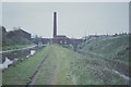
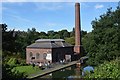
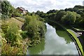
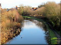
Living in B67 7ED means inhabiting a small, tightly knit residential cluster in England’s West Midlands, just beyond the edges of Birmingham’s urban sprawl. With a population of 2,077, the area feels compact yet functional, shaped by its history as part of Sandwell Borough. The postcode’s character is defined by its proximity to industrial heritage, such as the former Soho Foundry and Galton Valley, though modern life here balances historical roots with contemporary needs. Daily life is punctuated by the presence of nearby rail stations, retail outlets, and community-focused schools. The area’s modest size means residents are likely to know their neighbours, with a demographic skewed towards adults aged 30–64, reflecting a community rooted in stability and routine. While the population is small, the area’s connectivity to Birmingham and surrounding towns via rail and road ensures it is not isolated. For those seeking a place with a quiet, lived-in feel but easy access to larger urban amenities, B67 7ED offers a blend of practicality and historical context.
- Area Type
- Postcode
- Area Size
- Not available
- Population
- 2077
- Population Density
- 6252 people/km²
The property market in B67 7ED is characterised by a low home ownership rate of 24%, suggesting that the area is not a traditional owner-occupied neighbourhood but rather one where rental properties dominate. The accommodation type is primarily houses, which is notable for a small postcode area, implying a mix of older, possibly larger homes. This could indicate that the housing stock includes properties that are either family homes or converted units, though the limited data does not specify their condition or size. For buyers, this means the market is unlikely to be competitive in terms of property availability, but it also means that those seeking a house may find fewer options compared to areas with higher ownership rates. The small population and limited infrastructure suggest that the immediate surroundings may offer similar housing profiles, making it essential for buyers to consider broader regional markets if they require more choice.
House Prices in B67 7ED
No properties found in this postcode.
Energy Efficiency in B67 7ED
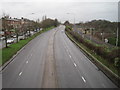
The lifestyle in B67 7ED is shaped by its proximity to retail, transport, and community hubs. Within practical reach are five retail outlets, including Asda Cape and Iceland Smethwick, offering everyday shopping convenience. The area’s five metro stops, such as Handsworth Booth Street, provide access to local parks and leisure facilities, though specific park names are not listed. The rail network, with stations like Smethwick Galton Bridge High Level, connects residents to broader regional amenities. While the data does not specify dining or leisure venues, the presence of multiple retail and transport points suggests a functional, service-oriented lifestyle. The area’s compact size means residents can access essentials without long commutes, though the lack of detailed information on local cafés or recreational spaces leaves some aspects of daily life unexplored.
Amenities
Schools
Near B67 7ED, Crockets Community Primary School stands out as a primary school with an outstanding Ofsted rating, offering parents a high-quality educational option for younger children. Alongside it, Arden School and Firs School provide special educational services, catering to students with specific needs. This mix of school types reflects a community that values both mainstream and specialist education. The presence of an outstanding primary school is a strong draw for families, though the lack of secondary schools in the immediate vicinity may require families to look further afield for secondary education. The combination of school types suggests that the area accommodates a range of educational requirements, from early years to specialist support, which is crucial for families with diverse needs.
| Rank | School | Type | Entry gender | Ages |
|---|
Explore more schools in this area
Go to Schools tabDemographics
The community in B67 7ED is predominantly composed of adults aged 30–64, with a median age of 47. This suggests a population largely in their prime working years, likely balancing employment with family responsibilities. Home ownership here is low at 24%, indicating that many residents rent their homes, which may reflect the area’s character as a smaller, possibly transient community. The accommodation type is primarily houses, which is unusual for a postcode of this scale but may point to a mix of older, detached properties. The predominant ethnic group is Asian, which influences the cultural and social fabric of the area. While no specific deprivation data is provided, the combination of low home ownership and a median age suggests a community that may rely more on local services and public transport. The presence of special schools nearby also hints at a population with diverse needs, including those requiring specialist education.
Household Size
Accommodation Type
Tenure
Ethnic Group
Religion
Household Composition
Age
Household Deprivation
NS-SEC
Explore more demographic insights in this area
Go to Demographics tabPlanning
Planning Constraints
- Flood RiskPremium
- Ramsar Wetland SitesPremium
- Area of Outstanding Natural BeautyPremium
- Protected Nature ReservePremium
- Protected WoodlandPremium