Area Overview for B67 7DF
Photos of B67 7DF


Area Information
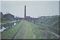
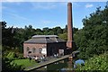
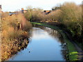
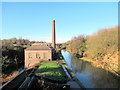
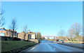
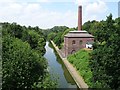
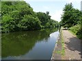
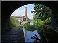
Living in B67 7DF means inhabiting a small, tightly knit residential cluster in England’s West Midlands. With a population of 1,739, the area is compact but functional, offering a mix of historical roots and modern convenience. Situated in Sandwell, it lies within reach of Birmingham’s urban sprawl yet retains a distinct local character. The community is shaped by its past as a former industrial hub, with remnants of 19th-century engineering legacies like the Soho Foundry and Galton Valley’s Telford canal still influencing the area’s identity. Daily life here balances proximity to urban amenities with a quieter, more residential feel. Residents benefit from nearby rail links, retail spots, and a range of schools, while the low crime score and minimal environmental risks contribute to a stable living environment. The area’s appeal lies in its accessibility, with major transport routes and digital connectivity supporting both work and leisure. For those seeking a blend of practicality and historical depth, B67 7DF offers a focused, community-oriented lifestyle.
- Area Type
- Postcode
- Area Size
- Not available
- Population
- 1739
- Population Density
- 10140 people/km²
The property market in B67 7DF is characterised by a high rate of home ownership (65%) and a predominance of houses. This suggests a market skewed towards owner-occupied properties rather than rental housing, likely catering to families or individuals seeking more spacious, long-term residences. The focus on houses rather than flats or apartments indicates a preference for traditional, standalone homes, which may appeal to buyers prioritising privacy and space. Given the area’s small size, the housing stock is limited, but the high ownership rate implies a relatively stable market with fewer speculative investments. Buyers should consider that the availability of properties may be constrained by the area’s compact nature, though the presence of nearby amenities and transport links could enhance the appeal of existing homes.
House Prices in B67 7DF
No properties found in this postcode.
Energy Efficiency in B67 7DF
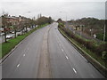
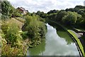
The lifestyle in B67 7DF is shaped by its proximity to essential amenities. Retail options like Farmfoods West and Asda Cape provide convenient access to groceries and household goods, while Iceland Smethwick caters to frozen food and specialty items. The area’s rail stations, such as Smethwick Galton Bridge High Level and Hawthorns, connect residents to nearby hubs, enhancing mobility for work or leisure. Metro stations like Kenrick Park and Trinity Way offer additional transport links, supporting both local and regional travel. Parks and open spaces, though not explicitly named, are likely accessible through nearby green corridors or community areas. The mix of retail, transport, and historical sites contributes to a balanced lifestyle, blending practicality with the area’s industrial heritage. Residents benefit from a compact yet functional environment where daily needs are met without the need for long commutes.
Amenities
Schools
Residents of B67 7DF have access to a range of primary schools, including Devonshire Junior School, Devonshire Infant School, and Smethwick Hall Girls’ School, all of which cater to younger children. Two academies, Devonshire Junior Academy and Devonshire Infant Academy, provide additional educational options. Notably, Devonshire Infant Academy holds an outstanding Ofsted rating, reflecting high standards in teaching and facilities. The mix of traditional schools and academies offers families flexibility in choosing educational paths. With multiple schools within proximity, the area supports a strong focus on education, making it appealing for families with children. The presence of both primary and academy institutions ensures a comprehensive schooling network, though no secondary schools are listed in the data.
| Rank | School | Type | Entry gender | Ages |
|---|
Explore more schools in this area
Go to Schools tabDemographics
The population of B67 7DF has a median age of 47, with the most common age group being adults aged 30–64. This suggests a mature, established community with a strong presence of middle-aged residents. Home ownership stands at 65%, indicating a majority of households own their properties, though a significant portion may rent. The accommodation is predominantly houses, reflecting a residential area suited to families or individuals seeking more space. The predominant ethnic group is Asian, which shapes the area’s cultural and social dynamics. While no specific deprivation data is provided, the demographic profile points to a stable, long-term resident base with a focus on housing security. The absence of younger age groups or high student populations implies a community centred on established households rather than transient populations.
Household Size
Accommodation Type
Tenure
Ethnic Group
Religion
Household Composition
Age
Household Deprivation
NS-SEC
Explore more demographic insights in this area
Go to Demographics tabPlanning
Planning Constraints
- Flood RiskPremium
- Ramsar Wetland SitesPremium
- Area of Outstanding Natural BeautyPremium
- Protected Nature ReservePremium
- Protected WoodlandPremium