Area Overview for B67 7DE
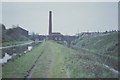
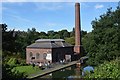
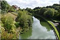
Photos of B67 7DE


Area Information
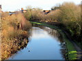
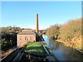
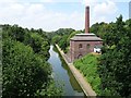
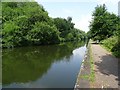
Living in B67 7DE means being part of a small, tightly knit residential cluster in England’s West Midlands, just 4 miles west of Birmingham city centre. With a population of 2,077, the area is compact but rich in historical and practical layers. Originally a hamlet in Staffordshire, Smethwick—where this postcode lies—has roots in industrial innovation, from Boulton and Watt’s Soho Foundry to Thomas Telford’s 1829 canal. Today, it balances heritage with modernity, offering residents proximity to Birmingham’s economic hubs while retaining a distinct local character. The community is predominantly Asian, with a median age of 47, reflecting a mature, family-oriented demographic. Daily life here is shaped by nearby amenities, including five rail stations, retail outlets like Asda and Iceland, and schools with strong Ofsted ratings. The area’s small size means a close-knit feel, but its connectivity to Birmingham and surrounding towns ensures access to broader opportunities. Whether you’re drawn to its history, convenience, or the mix of residential and industrial legacy, B67 7DE offers a defined, manageable footprint for those seeking a settled lifestyle.
- Area Type
- Postcode
- Area Size
- Not available
- Population
- 2077
- Population Density
- 6252 people/km²
B67 7DE’s property market is shaped by its 24% home ownership rate, which is significantly lower than the national average, suggesting a rental-heavy market. The accommodation type is predominantly houses, which is atypical for a small postcode area and may indicate a mix of semi-detached or detached properties. This could mean limited housing stock, making the area competitive for buyers. The low home ownership rate might reflect a transient population or a preference for renting, possibly due to economic factors or the area’s character as a commuter hub. For buyers, this dynamic implies that available properties may be in high demand, with limited scope for long-term equity growth. The focus on houses also means that the area may not cater to smaller households or first-time buyers seeking flats. Those considering purchase should factor in the small size of the postcode and the potential need to look beyond immediate surroundings for more options.
House Prices in B67 7DE
No properties found in this postcode.
Energy Efficiency in B67 7DE
The lifestyle in B67 7DE is defined by its proximity to a range of amenities. Retail options include Asda Cape, Iceland Smethwick, and Farmfoods Smethwick, providing everyday shopping convenience. Parks and open spaces are accessible via metro stops like Kenrick Park, offering recreational opportunities. The rail stations not only facilitate commuting but also connect residents to cultural and commercial hubs in Birmingham. The area’s mix of retail, transport, and green spaces creates a balanced lifestyle, blending practicality with leisure. While the small postcode size means amenities are concentrated, the presence of multiple rail and metro links ensures residents are not isolated from broader networks. This combination of local shops, transport, and nearby parks supports a community that values both convenience and connectivity, making daily life efficient and varied.
Amenities
Schools
The schools near B67 7DE include Crockets Community Primary School, which holds an outstanding Ofsted rating, and two special schools: Arden School and Firs School. Crockets’ high rating suggests a strong foundation for primary education, which is a key consideration for families. The presence of special schools indicates that the area caters to diverse educational needs, including support for students with specific learning requirements. However, the absence of secondary schools in the data means families may need to look further afield for comprehensive education. The mix of school types reflects a practical approach to meeting local needs, though it may not provide a full spectrum of schooling within the immediate vicinity. For parents prioritising primary education, Crockets offers a compelling advantage, but secondary schooling would require additional planning.
| Rank | School | Type | Entry gender | Ages |
|---|
Explore more schools in this area
Go to Schools tabDemographics
The population of B67 7DE is 2,077, with a median age of 47, indicating a mature community skewed toward adults aged 30–64. Home ownership here is low at 24%, suggesting a rental-dominated market, which may influence property values and availability. The predominant ethnic group is Asian, reflecting the area’s cultural makeup. Accommodation is primarily houses, which is unusual for a small postcode area, hinting at a mix of family homes and possibly larger properties. The absence of specific deprivation data means the quality of life cannot be fully contextualised, but the demographic profile suggests a stable, established population. The age range implies a community with a strong focus on family life and long-term residency. This profile may appeal to buyers seeking a quieter, more settled environment, though the low home ownership rate could signal limited opportunities for property investment or equity growth.
Household Size
Accommodation Type
Tenure
Ethnic Group
Religion
Household Composition
Age
Household Deprivation
NS-SEC
Explore more demographic insights in this area
Go to Demographics tabPlanning
Planning Constraints
- Flood RiskPremium
- Ramsar Wetland SitesPremium
- Area of Outstanding Natural BeautyPremium
- Protected Nature ReservePremium
- Protected WoodlandPremium