Area Overview for B67 7BF
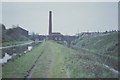
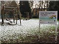
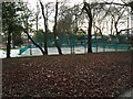
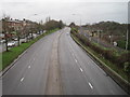
Photos of B67 7BF
Area Information
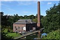
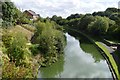
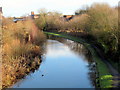
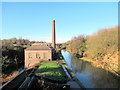
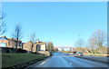
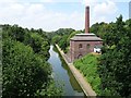
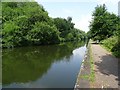
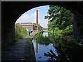
Living in B67 7BF means being part of a small, tightly knit residential cluster in the West Midlands, just 4 miles west of Birmingham city centre. With a population of 1,887, this area reflects a blend of historical industrial heritage and modern living. Smethwick, where B67 7BF is located, was once a hub for innovation, home to the Soho Foundry and the world’s oldest working engine, now housed in Birmingham’s Thinktank museum. Today, the area retains a distinct character, shaped by its past as a civil parish and its integration into Sandwell Borough. Residents here are predominantly adults aged 30–64, with a median age of 47, suggesting a community rooted in stability and experience. The postcode’s proximity to Birmingham offers easy access to urban amenities, while its quieter residential nature provides a contrast to the city’s pace. Daily life balances practicality with historical echoes, from local rail links to the remnants of 19th-century engineering.
- Area Type
- Postcode
- Area Size
- Not available
- Population
- 1887
- Population Density
- 8577 people/km²
The property market in B67 7BF is characterised by a focus on houses, with 46% of homes owner-occupied. This suggests a balance between private residences and rental properties, though the relatively low home ownership rate indicates a significant portion of the housing stock may be available for rent. Given the area’s small size and the prevalence of houses, the market is likely to be limited in scale, with properties concentrated in a compact cluster. Buyers should consider the immediate surroundings, as the postcode covers a small residential area. The presence of houses rather than apartments or flats may appeal to those seeking larger living spaces or family homes. However, the limited size of the area means competition for properties could be higher, and buyers may need to look beyond B67 7BF itself for more options.
House Prices in B67 7BF
No properties found in this postcode.
Energy Efficiency in B67 7BF
The lifestyle in B67 7BF is shaped by its proximity to essential amenities. Retail options include Asda Cape, Iceland Smethwick, and Farmfoods West, offering everyday shopping needs. The area’s rail and metro stations, such as Smethwick Rolfe Street and Kenrick Park, provide easy access to nearby towns and Birmingham’s broader network. Parks and open spaces are less explicitly detailed, but the presence of metro stations like Handsworth Booth Street may indicate nearby green spaces or leisure areas. The practical reach of these amenities ensures residents can manage daily tasks without long commutes. The area’s historical roots and modern connectivity create a balance between convenience and a sense of place, making it suitable for those who value accessibility without sacrificing a connection to the region’s heritage.
Amenities
Schools
| Rank | School | Type | Entry gender | Ages |
|---|
Explore more schools in this area
Go to Schools tabDemographics
The community in B67 7BF is predominantly composed of adults aged 30–64, with a median age of 47. This suggests a population that is largely settled, with fewer young families or retirees compared to other areas. Home ownership stands at 46%, indicating a mix of owner-occupied properties and rental units. The accommodation type is primarily houses, which aligns with the area’s traditional residential layout. The predominant ethnic group is White, though specific data on diversity is not provided. The absence of detailed information on deprivation or socioeconomic breakdown means the quality of life here cannot be fully contextualised with available figures. However, the age profile and home ownership rate suggest a community that values stability and long-term residency.
Household Size
Accommodation Type
Tenure
Ethnic Group
Religion
Household Composition
Age
Household Deprivation
NS-SEC
Explore more demographic insights in this area
Go to Demographics tabPlanning
Planning Constraints
- Flood RiskPremium
- Ramsar Wetland SitesPremium
- Area of Outstanding Natural BeautyPremium
- Protected Nature ReservePremium
- Protected WoodlandPremium