Area Overview for B67 6NH
Photos of B67 6NH
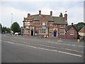
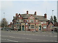

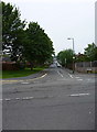
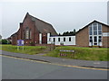
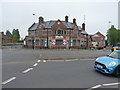
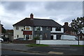
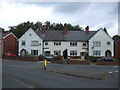
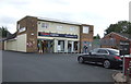


20 photos from this area
Area Information
Key information about the B67 6NH including its size, population, and administrative classification.
- Area Type
- Postcode
- Area Size
- 1.2 hectares
- Population
- 1835
- Population Density
- 5160 people/km²
House Prices in B67 6NH
39
Properties
£105,971
Average Sold Price
£38,500
Lowest Price
£187,250
Highest Price
Showing 39 properties
| Address | Type | Beds | Baths | Last Sale Price | Last Sale Date | |
|---|---|---|---|---|---|---|
| 75 Harvest Road, Smethwick, B67 6NH | Retail | 3 | 1 | £187,250 | Aug 2022 | |
| 58 Harvest Road, Smethwick, B67 6NH | house | - | - | £154,000 | Sep 2020 | |
| 48 Harvest Road, Smethwick, B67 6NH | Terraced | 3 | 1 | £140,000 | Apr 2018 | |
| 76 Harvest Road, Smethwick, B67 6NH | Semi-detached | 3 | 1 | £115,000 | Feb 2017 | |
| 51 Harvest Road, Smethwick, B67 6NH | house | - | - | £115,000 | Sep 2015 | |
| 74 Harvest Road, Smethwick, B67 6NH | Semi-detached | 3 | - | £115,000 | May 2015 | |
| 77 Harvest Road, Smethwick, B67 6NH | Semi-detached | 3 | 1 | £107,950 | May 2014 | |
| 83 Harvest Road, Smethwick, B67 6NH | house | - | - | £98,000 | Feb 2011 | |
| 89 Harvest Road, Smethwick, B67 6NH | Semi-detached | - | - | £79,500 | Sep 2003 | |
| 56 Harvest Road, Smethwick, B67 6NH | Semi-detached | - | - | £82,950 | Jul 2003 |
Page 1 of 4
Energy Efficiency in B67 6NH
Amenities
Schools
| Rank | School | Type | Entry gender | Ages |
|---|
Explore more schools in this area
Go to Schools tabDemographics
Household Size
Family (3-5 people)
most common
Accommodation Type
Houses
most common
Tenure
58
majority
Ethnic Group
White
most common
Religion
N/A
most common
Household Composition
N/A
most common
Age
47
median
Adults (30-64 years)
most common
Household Deprivation
N/A
with no deprivation
NS-SEC
19
in Lower managerial occupations
Explore more demographic insights in this area
Go to Demographics tabPlanning
Planning Constraints
- Flood RiskPremium
- Ramsar Wetland SitesPremium
- Area of Outstanding Natural BeautyPremium
- Protected Nature ReservePremium
- Protected WoodlandPremium