Area Overview for B67 6LF
Photos of B67 6LF
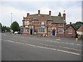
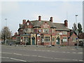

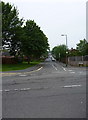
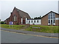
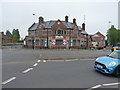
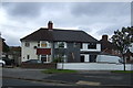
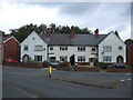
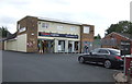


20 photos from this area
Area Information
Key information about the B67 6LF including its size, population, and administrative classification.
- Area Type
- Postcode
- Area Size
- 9044 m²
- Population
- 1835
- Population Density
- 5160 people/km²
House Prices in B67 6LF
33
Properties
£125,661
Average Sold Price
£100,000
Lowest Price
£155,000
Highest Price
Showing 33 properties
| Address | Type | Beds | Baths | Last Sale Price | Last Sale Date | |
|---|---|---|---|---|---|---|
| 92 The Oval, Smethwick, B67 6LF | Semi-detached | 3 | 1 | £152,000 | Mar 2020 | |
| 78 The Oval, Smethwick, B67 6LF | Terraced | 3 | 1 | £128,000 | Jan 2019 | |
| 122 The Oval, Smethwick, B67 6LF | Semi-detached | 3 | 1 | £155,000 | May 2018 | |
| 94 The Oval, Smethwick, B67 6LF | Semi-detached | 3 | 1 | £120,000 | May 2015 | |
| 86 The Oval, Smethwick, B67 6LF | Semi-detached | 3 | 1 | £110,000 | Oct 2014 | |
| 118 The Oval, Smethwick, B67 6LF | house | 3 | - | £100,000 | Oct 2011 | |
| 96 The Oval, Smethwick, B67 6LF | Semi-detached | 3 | - | £137,000 | Mar 2007 | |
| 88 The Oval, Smethwick, B67 6LF | Semi-detached | - | - | £123,950 | Mar 2006 | |
| 106 The Oval, Smethwick, B67 6LF | Semi-detached | - | - | £105,000 | Jun 2005 | |
| 120 The Oval, Smethwick, B67 6LF | house | 3 | 1 | - | - |
Page 1 of 4
Energy Efficiency in B67 6LF
Amenities
Schools
| Rank | School | Type | Entry gender | Ages |
|---|
Explore more schools in this area
Go to Schools tabDemographics
Household Size
Family (3-5 people)
most common
Accommodation Type
Houses
most common
Tenure
58
majority
Ethnic Group
White
most common
Religion
N/A
most common
Household Composition
N/A
most common
Age
47
median
Adults (30-64 years)
most common
Household Deprivation
N/A
with no deprivation
NS-SEC
19
in Lower managerial occupations
Explore more demographic insights in this area
Go to Demographics tabPlanning
Planning Constraints
- Flood RiskPremium
- Ramsar Wetland SitesPremium
- Area of Outstanding Natural BeautyPremium
- Protected Nature ReservePremium
- Protected WoodlandPremium