Area Overview for B67 6DF
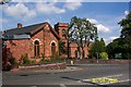
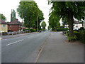
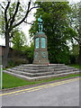
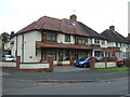
Photos of B67 6DF


Area Information
Living in B67 6DF means being part of a small, tightly knit residential cluster in Smethwick, a historically industrialised area now within Sandwell, West Midlands. With a population of 1,887, this postcode reflects a community rooted in the region’s 19th-century engineering legacy, from the Soho Foundry to Thomas Telford’s canal works. The area is just 4 miles west of Birmingham city centre, offering proximity to urban amenities while retaining a distinct local character. Daily life here balances practicality with historical resonance: residents can walk to nearby rail stations, enjoy retail options like Asda and Tesco, and explore remnants of Smethwick’s industrial past, such as the Smethwick Engine, now housed in Birmingham’s Thinktank museum. The area’s compact size means a sense of familiarity, with limited expansion but a focus on existing infrastructure. It’s a place where older homes predominate, and the community is shaped by its proximity to both Birmingham’s vibrancy and the quieter charm of Sandwell’s landscapes.
- Area Type
- Postcode
- Area Size
- Not available
- Population
- 1887
- Population Density
- 8577 people/km²
The property market in B67 6DF is defined by its low density and focus on owner-occupied homes. With 46% of properties owned by residents, the area is not dominated by rental housing, though the exact proportion of renters is unspecified. The accommodation type is primarily houses, which implies a lack of high-rise or apartment blocks, aligning with the area’s traditional, suburban feel. This makes B67 6DF appealing to buyers seeking family homes with space, though the small population size suggests limited housing stock. The compact nature of the postcode means buyers must consider nearby areas for more options. The presence of historic properties, such as the Grade II-listed Smethwick Library, adds to the area’s charm, though property values may reflect the need for maintenance in older buildings. For buyers, the market is likely niche, with fewer new developments but a strong sense of local identity.
House Prices in B67 6DF
No properties found in this postcode.
Energy Efficiency in B67 6DF
Daily life in B67 6DF is shaped by its proximity to a range of amenities. Residents can access major retail outlets like Asda and Tesco, ensuring convenience for grocery shopping, while Iceland Smethwick caters to those seeking frozen goods. The area’s rail network, with stations such as Smethwick Rolfe Street and Langley Green, connects to Birmingham and surrounding areas, making it easy to reach urban hubs. Metro stations like Kenrick Park and Trinity Way offer additional transport options, particularly for those using public transit for work or leisure. Parks and open spaces are less explicitly detailed, but the historical presence of Galton Valley and Smethwick Locks suggests opportunities for outdoor activity. The area’s character is defined by its blend of practicality and heritage, with landmarks like the Smethwick Engine and the Grade II-listed library adding cultural value. This mix of amenities supports a lifestyle that balances convenience with a connection to local history.
Amenities
Schools
| Rank | School | Type | Entry gender | Ages |
|---|
Explore more schools in this area
Go to Schools tabDemographics
The population of B67 6DF skews towards adults aged 30–64, with a median age of 47. This suggests a community of established professionals and families, rather than a high proportion of younger residents or retirees. Home ownership stands at 46%, indicating a mix of owner-occupied properties and rental stock. The area is predominantly composed of houses, not flats, reflecting a traditional housing stock. The predominant ethnic group is White, though specific data on diversity is not provided. The absence of detailed deprivation metrics means the area’s quality of life cannot be fully assessed, but the age profile and home ownership rate suggest a stable, middle-aged population with established ties to the locality. This demographic likely values the area’s historical character and practical transport links over rapid development or modern amenities.
Household Size
Accommodation Type
Tenure
Ethnic Group
Religion
Household Composition
Age
Household Deprivation
NS-SEC
Explore more demographic insights in this area
Go to Demographics tabPlanning
Planning Constraints
- Flood RiskPremium
- Ramsar Wetland SitesPremium
- Area of Outstanding Natural BeautyPremium
- Protected Nature ReservePremium
- Protected WoodlandPremium