Area Overview for B67 6AE
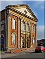
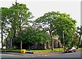
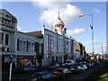
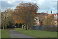
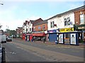
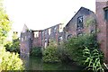
Photos of B67 6AE


Area Information
B67 6AE is a small, tightly knit residential cluster in the West Midlands, situated within the Borough of Sandwell. With a population of just 2077, it is a quiet, compact area defined by its historical roots and modern practicality. The postcode spans parts of Birmingham and Sandwell, lying along the A41 Soho Road, which historically separated it from nearby areas like Handsworth and Winson Green. The area’s character is shaped by its industrial past, including the legacy of Matthew Boulton’s Soho Manufactory, though today it is a residential hub with a mix of older homes and community spaces. The median age of 47 suggests a mature, stable population, with many residents in their prime working years. Despite its small size, B67 6AE offers proximity to multiple railway stations, retail outlets, and schools, making it a practical choice for those seeking a balance between convenience and a quieter lifestyle. Its compact nature means residents are close to amenities, but the area’s distinctiveness lies in its blend of historical significance and contemporary living.
- Area Type
- Postcode
- Area Size
- Not available
- Population
- 2077
- Population Density
- 6252 people/km²
The property market in B67 6AE is shaped by its low home ownership rate of 24%, which implies that the area is more oriented towards rental properties than owner-occupied homes. The accommodation type is predominantly houses, which is unusual for a small postcode area and may indicate a mix of older, family-sized homes. This housing profile suggests that the area is not a hotbed for property investment or speculative buying, as the market is likely to be stable rather than rapidly appreciating. For buyers, the limited number of homes available in the immediate vicinity means that opportunities may be scarce, requiring a broader search beyond the postcode. The presence of houses rather than flats may appeal to those seeking larger living spaces, but the overall market remains modest in scale.
House Prices in B67 6AE
No properties found in this postcode.
Energy Efficiency in B67 6AE
The lifestyle in B67 6AE is supported by a network of nearby amenities, including retail outlets such as Asda Cape, Iceland Smethwick, and Farmfoods Smethwick, which provide everyday shopping convenience. The area’s proximity to multiple railway and metro stations ensures easy access to public transport, while the A41 Soho Road serves as a central route for travel. Though the area is small, its residents are within reach of community hubs like Handsworth Library and historic sites such as Soho House, which is now a museum. The presence of these facilities, combined with the area’s compact size, fosters a sense of accessibility and practicality. While the selection of leisure and dining options may be limited compared to larger urban centres, the nearby retail and transport links compensate by offering a straightforward, efficient lifestyle.
Amenities
Schools
Residents of B67 6AE have access to a range of educational institutions, including Crockets Community Primary School, which holds an outstanding Ofsted rating, and two special schools: Arden School and Firs School. The mix of primary and special schools indicates that the area caters to a diverse range of educational needs, particularly for families with children requiring tailored support. Crockets Community Primary School’s high rating suggests a strong foundation for early education, while the special schools provide essential services for students with specific learning requirements. This combination ensures that families in the area have options for both mainstream and specialist schooling, though the absence of secondary schools nearby may necessitate travel for older students. The presence of these institutions reflects the community’s focus on accessibility and inclusivity in education.
| Rank | School | Type | Entry gender | Ages |
|---|
Explore more schools in this area
Go to Schools tabDemographics
The community in B67 6AE is predominantly composed of adults aged 30–64, reflecting a mature demographic with a median age of 47. Home ownership here is relatively low at 24%, indicating that a majority of residents are likely to be renters, which may influence the local property market’s dynamics. The area is characterised by a housing stock that includes primarily houses, rather than flats or apartments, which is uncommon in more densely populated urban areas. The predominant ethnic group is Asian, a reflection of immigration patterns from the Commonwealth in the mid-20th century. This diversity contributes to the area’s cultural fabric, though specific data on deprivation or socioeconomic challenges is not available. The presence of special schools nearby suggests a community that may include families with children requiring tailored educational support.
Household Size
Accommodation Type
Tenure
Ethnic Group
Religion
Household Composition
Age
Household Deprivation
NS-SEC
Explore more demographic insights in this area
Go to Demographics tabPlanning
Planning Constraints
- Flood RiskPremium
- Ramsar Wetland SitesPremium
- Area of Outstanding Natural BeautyPremium
- Protected Nature ReservePremium
- Protected WoodlandPremium