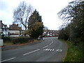
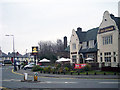
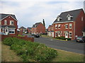
Area Overview for B67 5NP
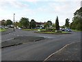
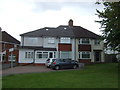
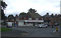
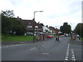
Photos of B67 5NP

Area Information
Living in B67 5NP means being part of a tightly knit residential community in England’s West Midlands. With a population of 1,520, this small postcode area is characterised by its compact scale and proximity to essential services. The area’s demographics suggest a mature, stable community, with a median age of 47 and a majority of residents aged 30–64. This reflects a neighbourhood where families and long-term residents predominate, contributing to a sense of continuity. The area’s housing stock is predominantly owner-occupied, with 73% of homes owned by residents rather than rented. While the postcode covers a limited geographical footprint, its strategic location near rail and metro links ensures connectivity to nearby towns and cities. Daily life here balances quiet residential living with access to shops, transport, and local amenities. The absence of environmental constraints such as protected woodlands or flood-prone areas means residents can enjoy a straightforward, low-risk lifestyle. For those seeking a settled, community-focused environment with practical infrastructure, B67 5NP offers a blend of stability and accessibility.
- Area Type
- Postcode
- Area Size
- Not available
- Population
- 1520
- Population Density
- 6454 people/km²
The property market in B67 5NP is dominated by owner-occupied homes, with 73% of properties owned by residents rather than rented. This suggests a community where long-term residency is the norm, and property ownership is a key feature of local life. The predominant accommodation type is houses, which may indicate a focus on family-friendly or larger homes. Given the small size of the postcode area, the housing stock is likely limited in volume, meaning buyers should consider the immediate surrounding areas for more options. The high home ownership rate implies a stable market with fewer rental properties, which could be advantageous for those seeking a place to settle rather than a short-term investment. However, the lack of data on property prices or recent sales trends means buyers should conduct further local research. The presence of nearby rail and metro stations may also influence property values, as transport links are often a key factor in housing demand.
House Prices in B67 5NP
No properties found in this postcode.
Energy Efficiency in B67 5NP
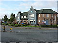
Residents of B67 5NP have access to a range of amenities within easy reach, enhancing daily life. Retail options include Heron Oldbury, Tesco Birmingham, and Co-op Hagley, providing essential shopping and dining choices. The area’s transport links are a key feature, with rail stations such as Langley Green and Rowley Regis offering connections to Birmingham and beyond. Metro stops like Handsworth Booth Street and Trinity Way further expand mobility, particularly for commuters. While the area’s compact size may not support large parks or leisure facilities, the presence of nearby stations and shops suggests a lifestyle focused on convenience and connectivity. The absence of major environmental constraints, such as protected woodlands or flood-prone zones, means residents can enjoy a straightforward, low-maintenance environment. For those who value accessibility over sprawling green spaces, B67 5NP offers a pragmatic balance of local amenities and transport options.
Amenities
Schools
| Rank | School | Type | Entry gender | Ages |
|---|
Explore more schools in this area
Go to Schools tabDemographics
The community in B67 5NP is defined by its age profile and home ownership patterns. With a median age of 47, the area is skewed towards adults aged 30–64, suggesting a population of working-age individuals and families. This age range aligns with the 73% home ownership rate, indicating a community where property ownership is common and likely tied to long-term residency. The predominant accommodation type is houses, which may reflect a preference for family homes or larger living spaces. The area’s demographic makeup is largely homogenous, with the White ethnic group forming the majority. While no specific data on deprivation is provided, the high home ownership rate and low crime risk suggest a relatively stable socioeconomic environment. This stability may contribute to a sense of security and continuity for residents. The absence of younger or older demographic groups means the area may lack the diversity of age and experience found in more mixed communities.
Household Size
Accommodation Type
Tenure
Ethnic Group
Religion
Household Composition
Age
Household Deprivation
NS-SEC
Explore more demographic insights in this area
Go to Demographics tabPlanning
Planning Constraints
- Flood RiskPremium
- Ramsar Wetland SitesPremium
- Area of Outstanding Natural BeautyPremium
- Protected Nature ReservePremium
- Protected WoodlandPremium