Area Overview for B67 5NL
Photos of B67 5NL

Area Information
Living in B67 5NL offers a settled experience within a specific residential cluster in England. This postcode covers a small population of 1,520 people, creating a close-knit environment that feels distinct from larger urban sprawls. The area is defined by its compact nature, where residents share a clear community identity. Daily life here centres on stability and local familiarity rather than rapid change or transient movements. You will find a neighbourhood where the pace of life is governed by established routines. The demographic profile suggests a mature community, with the median age sitting at 47 years. Most residents fall into the 30 to 64 age range, indicating a demographic focused on family life, established careers, and long-term planning. This age distribution shapes the local culture, prioritising practical needs over trendy developments. When you consider homes in B67 5NL, you are entering an environment built on continuity. The area does not rely on major commercial hubs for its identity, which keeps a focus on quiet living. Your experience will be shaped by proximity to known local spots like Heron Oldbury and Bearwood. This specific postcode represents a slice of Birmingham life that values established neighbourhoods over expansion.
- Area Type
- Postcode
- Area Size
- Not available
- Population
- 1520
- Population Density
- 6454 people/km²
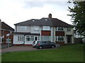
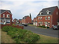
The property market in B67 5NL is characterised by a strong preference for ownership rather than renting. With 73% of residents owning their homes, the area stands in contrast to high-rental zones where turnover is frequent. If you are looking at homes in B67 5NL, you will find that houses are the primary accommodation type. This indicates a market driven by family needs and the desire for space. Buyer interest here often focuses on main residences rather than buy-to-let investments. The high ownership rate suggests stability; landlords do not dominate the streets, so neighbours remain consistent over years. This lowers noise from property turnovers and creates a quieter residential environment. When you compare this to newer builds where rentals are common, B67 5NL feels more secure. The market does not revolve around temporary tenancy agreements or frequent lease renewals. Instead, transactions involve established owners selling to new families who plan to stay. This dynamic means you will not find large blocks of social housing or purpose-built luxury rentals. The 1,520 residents live in a mix of private homes, reinforcing the homeowner-led culture. You should approach the local market with an eye toward permanence and established value.
House Prices in B67 5NL
No properties found in this postcode.
Energy Efficiency in B67 5NL
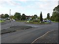
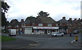
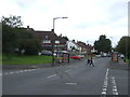
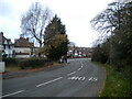
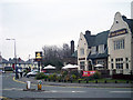
Your lifestyle in B67 5NL benefits from immediate access to key retail and transport amenities just outside the residential cluster. You can reach Heron Oldbury, Tesco Birmingham, and Iceland Bearwood for your weekly shopping and household needs. These venues are within practical reach, meaning you do not require a long commute just to collect groceries or return essentials. For daily travel, five railway stations and five metro stops serve the wider area effectively. Key rail hubs include Langley Green, Smethwick Rolfe Street, and Smethwick Galton Bridge High Level. You can also access Kenrick Park, Handsworth Booth Street, and Trinity Way via the metro network. This connectivity ensures you can reach Birmingham city centre or the West Midlands heartland quickly. Your daily errands involve short car trips or train journeys rather than lengthy commutes. The presence of major retailers like Tesco and Iceland means you do not rely on small local shopkeepers for basics. Parks and transport interchanges are close enough to make weekends enjoyable without spending hours in traffic. This balance of accessibility and residential quiet defines the living experience in this postcode.
Amenities
Schools
| Rank | School | Type | Entry gender | Ages |
|---|
Explore more schools in this area
Go to Schools tabDemographics
The community in B67 5NL reflects a stable, established demographic rather than a young or transient population. Data confirms that 73% of households own their homes, which signals deep roots in the area. You are surrounded by people who have chosen these streets as a permanent base. Most residents work within the 30-64 year age bracket, suggesting the area suits families and individuals with settled lives. The predominant ethnic group is White, which aligns with the broader profile of historic postcodes in parts of England. Houses dominate the accommodation type, meaning you will likely find detached or semi-detached properties rather than high-rise apartments or managed flats. This housing stock supports a lifestyle where outdoor space and garden privacy matter significantly. The high home ownership rate of 73% means rental speculation is minimal compared to other parts of the country. Investments here tend to be viewed as long-term holds by owners rather than short-term rentals. When you examine the age statistics, the median age of 47 reinforces the idea that this is a place for later-life settlement and maturity. There are no signs of rapid demographic shifts disrupting the local character. You can expect to meet neighbours who have lived in the valley or cluster for decades.
Household Size
Accommodation Type
Tenure
Ethnic Group
Religion
Household Composition
Age
Household Deprivation
NS-SEC
Explore more demographic insights in this area
Go to Demographics tabPlanning
Planning Constraints
- Flood RiskPremium
- Ramsar Wetland SitesPremium
- Area of Outstanding Natural BeautyPremium
- Protected Nature ReservePremium
- Protected WoodlandPremium