Area Overview for B67 5ET
Photos of B67 5ET


Area Information
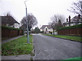
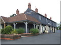
B67 5ET is a small residential postcode area in England, home to 1,592 people. Nestled in the Quinton suburb of Birmingham, it lies approximately 5 miles west of the city centre, near coordinates 52.460706, -1.995232. Historically part of Halesowen parish, the area was incorporated into Birmingham in 1909 after a local vote for improved drainage. Quinton retains a village-like character, with its original Victorian terraced homes and green spaces preserved amid post-1980s housing estates. The area is marked by quiet streets and proximity to Woodgate Valley Country Park, offering a balance of suburban living and natural amenities. Residents benefit from easy access to Birmingham’s motorways, including the M5, which runs close to the area. With a population skewed toward adults aged 30–64 and a median age of 47, B67 5ET reflects a mature, settled community. Its compact size means amenities and services are within practical reach, making it appealing for those seeking a quieter, family-oriented environment without sacrificing connectivity to the city.
- Area Type
- Postcode
- Area Size
- Not available
- Population
- Not available
- Population Density
- Not available
B67 5ET is predominantly an owner-occupied area, with 79% of homes owned by residents rather than rented. The accommodation type is primarily houses, reflecting a suburban layout with individual properties rather than apartments or flats. This suggests a market skewed towards family homes, with limited rental availability. The small size of the postcode area means the housing stock is relatively compact, with opportunities for buyers to find properties in a close-knit community. The presence of houses rather than flats may appeal to those seeking more space or garden areas. However, the limited scale of the area means the immediate surroundings—such as nearby Quinton or Hagley—may offer additional options. Buyers should consider the area’s maturity, with homes likely to be older or mid-century properties, and potential for long-term value retention given the stable demographic profile.
House Prices in B67 5ET
No properties found in this postcode.
Energy Efficiency in B67 5ET
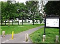
Living in B67 5ET offers access to a range of amenities within practical reach. Retail options include Iceland Bearwood, Co-op Hagley, and Aldi Warley, providing everyday shopping needs. The area’s transport links connect residents to nearby leisure and cultural hubs. Green spaces such as Quinton Recreation Ground and Woodgate Valley Country Park offer opportunities for outdoor activities, walking, or relaxation. The historical character of Quinton, with its preserved Victorian terraces and village core, adds a unique charm to daily life. The presence of the Quinton Library and Quinborne Community Centre suggests community engagement and local events. While the area is small, its proximity to Birmingham ensures access to larger facilities, from theatres to supermarkets. The mix of retail, transport, and green spaces creates a convenient, balanced lifestyle for residents.
Amenities
Schools
The nearest school to B67 5ET is Our Lady of Fatima Catholic Primary School, a primary school with an Ofsted rating of satisfactory. This school serves the local community, providing education for younger children in the area. The presence of a primary school indicates a focus on family-friendly infrastructure, though no secondary schools are listed in the data. Families relying on this school may need to consider proximity to secondary education in nearby areas. The satisfactory Ofsted rating suggests the school meets acceptable standards but may not be outstanding. For parents, this means a reliable option for primary education, though further research into secondary schooling would be necessary for long-term planning.
| Rank | School | Type | Entry gender | Ages |
|---|
Explore more schools in this area
Go to Schools tabDemographics
The population of B67 5ET is 1,592, with a median age of 47, indicating a mature demographic. The most common age range is adults aged 30–64, suggesting a stable, established community. Home ownership is high at 79%, with houses being the predominant type of accommodation. The area’s predominant ethnic group is Asian_total, reflecting a culturally diverse yet cohesive neighbourhood. This demographic profile implies a mix of long-term residents and families prioritising stability. The absence of specific deprivation data means quality of life is inferred through factors like low crime rates and access to amenities. The age distribution suggests a community with a strong presence of working-age adults, potentially supporting local businesses and schools. The high home ownership rate indicates a preference for long-term residency over rental properties, which may influence the area’s character and property values.
Household Size
Accommodation Type
Tenure
Ethnic Group
Religion
Household Composition
Age
Household Deprivation
NS-SEC
Explore more demographic insights in this area
Go to Demographics tabPlanning
Planning Constraints
- Flood RiskPremium
- Ramsar Wetland SitesPremium
- Area of Outstanding Natural BeautyPremium
- Protected Nature ReservePremium
- Protected WoodlandPremium