Area Overview for B67 5EJ
Photos of B67 5EJ
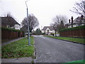
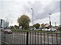
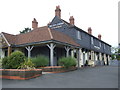

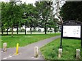
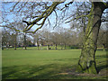
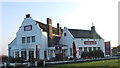
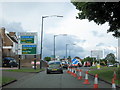
18 photos from this area
Area Information
Key information about the B67 5EJ including its size, population, and administrative classification.
- Area Type
- Postcode
- Area Size
- 1.0 hectares
- Population
- 1455
- Population Density
- 1966 people/km²
House Prices in B67 5EJ
26
Properties
£201,339
Average Sold Price
£62,000
Lowest Price
£440,000
Highest Price
Showing 26 properties
| Address | Type | Beds | Baths | Last Sale Price | Last Sale Date | |
|---|---|---|---|---|---|---|
| 8 Devon Road, Smethwick, B67 5EJ | Terraced | 4 | 1 | £312,500 | Jan 2025 | |
| 70 Devon Road, Smethwick, B67 5EJ | Detached | 4 | 1 | £440,000 | Oct 2023 | |
| 36 Devon Road, Smethwick, B67 5EJ | Terraced | 3 | 1 | £300,000 | Feb 2022 | |
| 88 Devon Road, Smethwick, B67 5EJ | house | - | - | £370,000 | Dec 2021 | |
| 80 Devon Road, Smethwick, B67 5EJ | Terraced | 3 | 1 | £250,000 | Oct 2016 | |
| 34 Devon Road, Smethwick, B67 5EJ | house | 4 | 1 | £207,500 | Sep 2014 | |
| 38 Devon Road, Smethwick, B67 5EJ | Terraced | 3 | 1 | £164,500 | Aug 2014 | |
| 42 Devon Road, Smethwick, B67 5EJ | Bungalow | 2 | - | £180,000 | Nov 2013 | |
| 76 Devon Road, Smethwick, B67 5EJ | house | 3 | - | £190,000 | Jun 2012 | |
| 92 Devon Road, Smethwick, B67 5EJ | house | 4 | - | £250,000 | Jul 2011 |
Page 1 of 3
Energy Efficiency in B67 5EJ
Amenities
Schools
| Rank | School | Type | Entry gender | Ages |
|---|
Explore more schools in this area
Go to Schools tabDemographics
Household Size
Family (3-5 people)
most common
Accommodation Type
Houses
most common
Tenure
76
majority
Ethnic Group
White
most common
Religion
N/A
most common
Household Composition
N/A
most common
Age
47
median
Adults (30-64 years)
most common
Household Deprivation
N/A
with no deprivation
NS-SEC
49
in Lower managerial occupations
Explore more demographic insights in this area
Go to Demographics tabPlanning
Planning Constraints
- Flood RiskPremium
- Ramsar Wetland SitesPremium
- Area of Outstanding Natural BeautyPremium
- Protected Nature ReservePremium
- Protected WoodlandPremium