Area Overview for B67 5AS
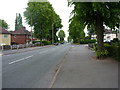
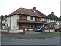
Photos of B67 5AS


Area Information
Living in B67 5AS means being part of a tightly knit residential cluster in England, where 1,730 people inhabit just 3,571 square metres. This high population density creates a compact, community-oriented environment, ideal for those seeking proximity to amenities without sprawling urban sprawl. The area’s character is defined by its mix of practical living and connectivity. Residents benefit from nearby rail and metro stations, including Smethwick Rolfe Street and Kenrick Park, which link to broader networks. The median age of 47 suggests a mature demographic, with many households likely to be established families or professionals. The presence of Bearwood Primary School, rated ‘good’ by Ofsted, adds to the area’s appeal for families. Digital connectivity is a standout feature, with a broadband score of 98, ensuring seamless online access for work or leisure. While the area is small, its strategic location near retail outlets like Aldi Warley and Iceland Bearwood, combined with transport links, makes it a practical choice for those prioritising convenience and accessibility.
- Area Type
- Postcode
- Area Size
- 3571 m²
- Population
- 1730
- Population Density
- 7867 people/km²
The property market in B67 5AS is characterised by a low home ownership rate of 37%, suggesting that the majority of properties are rented rather than owner-occupied. This contrasts with the accommodation type, which is primarily houses, indicating a limited supply of flats or apartments. The small area size of 3,571 square metres means the housing stock is constrained, potentially driving competition among buyers. For those seeking homes in B67 5AS, the focus is likely on existing houses rather than new developments. Buyers may need to consider nearby areas for more options, given the area’s compact nature. The low home ownership rate also implies that rental demand is strong, which could influence property values and availability. The mix of houses and limited housing diversity may appeal to those prioritising space over density but could pose challenges for first-time buyers seeking affordability.
House Prices in B67 5AS
No properties found in this postcode.
Energy Efficiency in B67 5AS
Residents of B67 5AS have access to a range of nearby amenities, including retail outlets like Aldi Warley and Iceland Bearwood, which cater to everyday shopping needs. The area’s proximity to rail and metro stations, such as Smethwick Galton Bridge High Level Railway Station, ensures easy access to broader networks for leisure, work, or travel. While specific parks or leisure facilities are not detailed in the data, the presence of multiple transport hubs suggests a well-connected lifestyle. The compact nature of the area means amenities are within walking or short transit distance, reducing the need for long commutes. This accessibility enhances daily life, allowing residents to balance convenience with the ability to explore larger urban centres. The mix of retail and transport options supports a practical, community-focused lifestyle, ideal for those prioritising ease of access over expansive green spaces.
Amenities
Schools
The nearest school to B67 5AS is Bearwood Primary School, which serves the local community with a ‘good’ Ofsted rating. This school is a key asset for families, providing quality primary education within walking distance. The absence of secondary schools in the immediate vicinity means students may need to travel to nearby areas for further education, though the rail and metro connections, including Smethwick Galton Bridge High Level Railway Station, facilitate such commutes. The presence of a well-rated primary school enhances the area’s appeal for families, ensuring children have access to a solid educational foundation. However, the limited range of school types within B67 5AS itself means parents may need to plan for additional transportation or consider broader school catchment areas when deciding on a home.
| Rank | School | Type | Entry gender | Ages |
|---|
Explore more schools in this area
Go to Schools tabDemographics
The community in B67 5AS is predominantly composed of adults aged 30–64, with a median age of 47. This suggests a stable population of working-age individuals and families, rather than a younger or elderly demographic. Home ownership rates are relatively low at 37%, indicating that a significant portion of the housing stock is rented. The accommodation type is primarily houses, which is unusual in high-density areas, suggesting a mix of detached or semi-detached properties. The predominant ethnic group is White, reflecting a homogenous demographic profile. While no specific data on deprivation is provided, the high population density and limited housing stock may impact affordability and housing availability. The age profile implies a community focused on established living, with fewer young families or retirees compared to other areas.
Household Size
Accommodation Type
Tenure
Ethnic Group
Religion
Household Composition
Age
Household Deprivation
NS-SEC
Explore more demographic insights in this area
Go to Demographics tabPlanning
Planning Constraints
- Flood RiskPremium
- Ramsar Wetland SitesPremium
- Area of Outstanding Natural BeautyPremium
- Protected Nature ReservePremium
- Protected WoodlandPremium