Area Overview for B66 4AN
Photos of B66 4AN

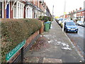
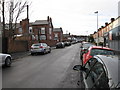
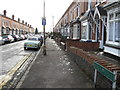

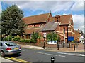

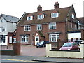
44 photos from this area
Area Information
Key information about the B66 4AN including its size, population, and administrative classification.
- Area Type
- Postcode
- Area Size
- 9508 m²
- Population
- Not available
- Population Density
- Not available
House Prices in B66 4AN
36
Properties
£134,514
Average Sold Price
£52,000
Lowest Price
£205,000
Highest Price
Showing 36 properties
| Address | Type | Beds | Baths | Last Sale Price | Last Sale Date | |
|---|---|---|---|---|---|---|
| 38 Poplar Road, Smethwick, B66 4AN | Terraced | 5 | 2 | £200,000 | Sep 2025 | |
| 76 Poplar Road, Smethwick, B66 4AN | Terraced | 3 | 1 | £205,000 | Oct 2024 | |
| 75 Poplar Road, Smethwick, B66 4AN | Terraced | 2 | 1 | £188,000 | Sep 2023 | |
| 53 Poplar Road, Smethwick, B66 4AN | house | 3 | 1 | £185,000 | May 2019 | |
| 77 Poplar Road, Smethwick, B66 4AN | Terraced | 2 | 1 | £143,000 | Jul 2018 | |
| 70 Poplar Road, Smethwick, B66 4AN | Terraced | 5 | 5 | £161,000 | Apr 2018 | |
| 41 Poplar Road, Smethwick, B66 4AN | Terraced | 3 | 2 | £114,000 | Aug 2013 | |
| 82 Poplar Road, Smethwick, B66 4AN | house | - | - | £115,000 | Dec 2010 | |
| 78 Poplar Road, Smethwick, B66 4AN | Terraced | 2 | 1 | £125,000 | May 2007 | |
| 80 Poplar Road, Smethwick, B66 4AN | Terraced | - | - | £143,950 | Aug 2004 |
Page 1 of 4
Energy Efficiency in B66 4AN
Amenities
Schools
| Rank | School | Type | Entry gender | Ages |
|---|
Explore more schools in this area
Go to Schools tabDemographics
Household Size
One person
most common
Accommodation Type
Houses
most common
Tenure
53
majority
Ethnic Group
White
most common
Religion
N/A
most common
Household Composition
N/A
most common
Age
47
median
Adults (30-64 years)
most common
Household Deprivation
N/A
with no deprivation
NS-SEC
36
in Lower managerial occupations
Explore more demographic insights in this area
Go to Demographics tabPlanning
Planning Constraints
- Flood RiskPremium
- Ramsar Wetland SitesPremium
- Area of Outstanding Natural BeautyPremium
- Protected Nature ReservePremium
- Protected WoodlandPremium