Area Overview for B66 3PF
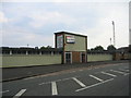
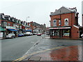
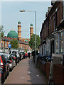
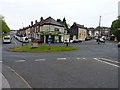
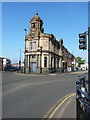
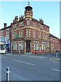
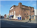
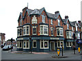
Photos of B66 3PF
Area Information
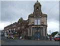
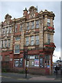
Soho and Victoria, accessed via postcode B66 3PF, is a distinct unitary ward within the Borough of Sandwell, West Midlands. This residential cluster sits along the A41 Soho Road, acting as a boundary line between the communities of Handsworth and Winson Green, while simultaneously spanning parts of both Birmingham and Sandwell metropolitan boroughs. The area has deep historical roots, tracing its origins back to a single cottage marked on William Yates' 1777 map of Staffordshire. Once an industrial heartland defined by Matthew Boulton's Soho Manufactory and Soho Works from the 18th century, the neighbourhood evolved through 19th-century expansion into a hub of factories and housing. Significant demographic shifts occurred in the mid-20th century with post-war immigration from the Commonwealth, primarily India, followed by extensive council housebuilding during the 1960s and 1970s. Today, Soho and Victoria functions as a recognised urban area that blends its industrial heritage with modern community needs. The site of the former manufactory now houses Soho House, a community museum operated by Birmingham Museums & Art Gallery. For residents of B66 3PF, daily life involves navigating this historic urban landscape, which includes the dedicated parish church of St John Chrysostom and serves as a key access point for both the broader city and its surrounding districts.
- Area Type
- Postcode
- Area Size
- Not available
- Population
- 2240
- Population Density
- 14631 people/km²
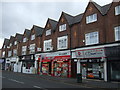
Living in B66 3PF means entering a property market defined largely by houses and a mixed tenure split. With 47% of residents in the area as owner-occupiers, the neighbourhood maintains a healthy balance between private owners and renters, which often points to stability in the housing stock. The predominant accommodation type here is houses, a fact that stands in contrast to densely populated city centres where flats usually command the majority of listings. This specific focus on houses for homes in B66 3PF suggests properties built with space for gardens or private outdoor areas, aligning with the area's historical development patterns from the 1960s and 1970s period of council housebuilding. Buyers looking at this postcode should note that the available inventory will skew heavily towards residential properties suited for families or couples, rather than high-rise rentals. The sheer concentration of houses implies that if you are seeking a property with more ground floor space or driveway access, your options are better here than in旁边的 urban fringe districts. This mix of tenure and type creates a typical local market where bidding wars may occur for well-maintained family homes, while rental yields remain relevant given the substantial non-owner-occupier population.
House Prices in B66 3PF
No properties found in this postcode.
Energy Efficiency in B66 3PF
Shopping and leisure facilities are plentiful for you if you are living in B66 3PF. Retail options are well-distributed, with five key shopping centres nearby. Notable names include Iceland Smethwick, Asda Cape, and Farmfoods Smethwick, all located within easy travelling distance. These venues provide comprehensive groceries, household essentials, and weekly shopping trips without the need for lengthy commutes. For those preferring public transit over cars, rail connectivity remains superior, with five railway stations serving the local community. Smethwick Galton Bridge High Level Railway Station and Hawthorns Railway Station stand out as primary hubs, allowing quick transfers to other parts of the West Midlands. Beyond rail, the area benefits from five nearby metro stops, including Winson Green Outer Circle and Soho Benson Road. These tube stations link directly to the broader Birmingham transport grid. The combination of these amenities ensures a self-contained lifestyle where daily errands, social outings, and longer commutes can be managed efficiently. Retail density means you rarely need to travel far for basic needs, while the rail and metro network extends your practical reach to leisure destinations across the region.
Amenities
Schools
| Rank | School | Type | Entry gender | Ages |
|---|
Explore more schools in this area
Go to Schools tabDemographics
The population of B66 3PF stands at 2,240 residents, creating a tightly knit community where household dynamics reflect life in middle adulthood. The most common age range for those living here spans adults between 30 and 64 years, with a median age of 47 years. This profile indicates a neighbourhood dominated by established householders rather than students or young families moving in. Homes in B66 3PF are predominantly houses, catering to families or individuals seeking detached or semi-detached living spaces rather than flats. Community diversity is significant, with the Asian total group forming the predominant ethnic demographic within the ward's composition. Regarding housing tenure, just over 47% of residents own their homes outright or with a mortgage, meaning nearly half rely on the private rental market. This specific proportion of ownership suggests a balanced market where both sitting tenants and new buyers have established a presence, particularly given the prevalence of houses in the stock. The demographic picture of a 47-year-old median resident owning or renting a house contributes to a stable, long-term neighbourhood character.
Household Size
Accommodation Type
Tenure
Ethnic Group
Religion
Household Composition
Age
Household Deprivation
NS-SEC
Explore more demographic insights in this area
Go to Demographics tabPlanning
Planning Constraints
- Flood RiskPremium
- Ramsar Wetland SitesPremium
- Area of Outstanding Natural BeautyPremium
- Protected Nature ReservePremium
- Protected WoodlandPremium