Area Overview for B66 3JB
Photos of B66 3JB
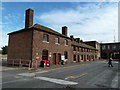
100 photos from this area
Area Information
Key information about the B66 3JB including its size, population, and administrative classification.
- Area Type
- Postcode
- Area Size
- 1.3 hectares
- Population
- 1477
- Population Density
- 1594 people/km²
House Prices in B66 3JB
69
Properties
£138,500
Average Sold Price
£63,000
Lowest Price
£200,000
Highest Price
Showing 69 properties
| Address | Type | Beds | Baths | Last Sale Price | Last Sale Date | |
|---|---|---|---|---|---|---|
| 52 Rosedale Avenue, Smethwick, B66 3JB | Terraced | 4 | 1 | £200,000 | May 2024 | |
| 64 Rosedale Avenue, Smethwick, B66 3JB | Terraced | 3 | - | £190,000 | Apr 2024 | |
| 62 Rosedale Avenue, Smethwick, B66 3JB | house | 3 | - | £150,000 | Dec 2021 | |
| 25 Rosedale Avenue, Smethwick, B66 3JB | Terraced | 6 | 5 | £132,500 | Apr 2018 | |
| 17 Rosedale Avenue, Smethwick, B66 3JB | house | - | - | £63,000 | Mar 2008 | |
| 70 Rosedale Avenue, Smethwick, B66 3JB | Terraced | - | - | £95,500 | Mar 2006 | |
| 58 Rosedale Avenue, Smethwick, B66 3JB | Terraced | 3 | 2 | - | - | |
| 4 Rosedale Avenue, Smethwick, B66 3JB | house | 4 | 1 | - | - | |
| 44 Rosedale Avenue, Smethwick, B66 3JB | house | - | - | - | - | |
| 10 Rosedale Avenue, Smethwick, B66 3JB | house | - | - | - | - |
Page 1 of 7
Energy Efficiency in B66 3JB
Amenities
Schools
| Rank | School | Type | Entry gender | Ages |
|---|
Explore more schools in this area
Go to Schools tabDemographics
Household Size
Family (3-5 people)
most common
Accommodation Type
Houses
most common
Tenure
29
majority
Ethnic Group
asian_total
most common
Religion
N/A
most common
Household Composition
N/A
most common
Age
22
median
Adults (30-64 years)
most common
Household Deprivation
N/A
with no deprivation
NS-SEC
14
in Lower managerial occupations
Explore more demographic insights in this area
Go to Demographics tabPlanning
Planning Constraints
- Flood RiskPremium
- Ramsar Wetland SitesPremium
- Area of Outstanding Natural BeautyPremium
- Protected Nature ReservePremium
- Protected WoodlandPremium