Area Overview for B66 2DF
Photos of B66 2DF
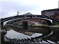
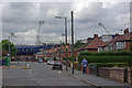
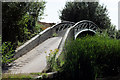


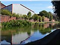

62 photos from this area
Area Information
Key information about the B66 2DF including its size, population, and administrative classification.
- Area Type
- Postcode
- Area Size
- 8833 m²
- Population
- 1481
- Population Density
- 2940 people/km²
House Prices in B66 2DF
49
Properties
£83,274
Average Sold Price
£20,000
Lowest Price
£250,000
Highest Price
Showing 49 properties
| Address | Type | Beds | Baths | Last Sale Price | Last Sale Date | |
|---|---|---|---|---|---|---|
| 68-70 Sydenham Road, Smethwick, B66 2DF | house | 6 | - | £175,000 | Aug 2023 | |
| 98 Sydenham Road, Smethwick, B66 2DF | house | - | - | £96,000 | Jun 2022 | |
| 93 Sydenham Road, Smethwick, B66 2DF | house | - | - | £140,000 | Sep 2021 | |
| 77 Sydenham Road, Smethwick, B66 2DF | Terraced | 3 | - | £145,000 | Jun 2021 | |
| 60 Sydenham Road, Smethwick, B66 2DF | house | - | - | £90,000 | Feb 2021 | |
| 109 Sydenham Road, Smethwick, B66 2DF | Terraced | 2 | 1 | £105,000 | Sep 2019 | |
| 82 Sydenham Road, Smethwick, B66 2DF | Land | - | - | £250,000 | Feb 2018 | |
| 61 Sydenham Road, Smethwick, B66 2DF | Terraced | 3 | 1 | £105,000 | Jul 2017 | |
| 63 Sydenham Road, Smethwick, B66 2DF | Terraced | 3 | 1 | £103,500 | May 2017 | |
| 62 Sydenham Road, Smethwick, B66 2DF | house | - | - | £100,000 | Oct 2016 |
Page 1 of 5
Energy Efficiency in B66 2DF
Amenities
Schools
| Rank | School | Type | Entry gender | Ages |
|---|
Explore more schools in this area
Go to Schools tabDemographics
Household Size
Family (3-5 people)
most common
Accommodation Type
Houses
most common
Tenure
53
majority
Ethnic Group
asian_total
most common
Religion
N/A
most common
Household Composition
N/A
most common
Age
47
median
Adults (30-64 years)
most common
Household Deprivation
N/A
with no deprivation
NS-SEC
10
in Lower managerial occupations
Explore more demographic insights in this area
Go to Demographics tabPlanning
Planning Constraints
- Flood RiskPremium
- Ramsar Wetland SitesPremium
- Area of Outstanding Natural BeautyPremium
- Protected Nature ReservePremium
- Protected WoodlandPremium