Area Overview for B66 1EH
Photos of B66 1EH

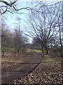
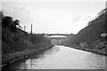
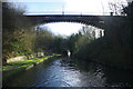

100 photos from this area
Area Information
Key information about the B66 1EH including its size, population, and administrative classification.
- Area Type
- Postcode
- Area Size
- 2754 m²
- Population
- 1869
- Population Density
- 14256 people/km²
House Prices in B66 1EH
12
Properties
£92,067
Average Sold Price
£33,000
Lowest Price
£225,000
Highest Price
Showing 12 properties
| Address | Type | Beds | Baths | Last Sale Price | Last Sale Date | |
|---|---|---|---|---|---|---|
| 33 St Pauls Road, Smethwick, B66 1EH | Terraced | 3 | 1 | £225,000 | Dec 2023 | |
| 40 St Pauls Road, Smethwick, B66 1EH | house | - | - | £100,000 | Oct 2014 | |
| 31 St Pauls Road, Smethwick, B66 1EH | Terraced | - | - | £98,500 | Jul 2005 | |
| 39 St Pauls Road, Smethwick, B66 1EH | Terraced | - | - | £55,000 | Jul 2004 | |
| 32 St Pauls Road, Smethwick, B66 1EH | Terraced | - | - | £40,900 | Jun 1999 | |
| 36 St Pauls Road, Smethwick, B66 1EH | Terraced | - | - | £33,000 | Jun 1995 | |
| Flat, St Pauls Road Post Office, 30 St Pauls Road, Smethwick, B66 1EH | Flat | - | - | - | - | |
| 34 St Pauls Road, Smethwick, B66 1EH | Terraced | - | - | - | - | |
| 37 St Pauls Road, Smethwick, B66 1EH | house | - | - | - | - | |
| 35 St Pauls Road, Smethwick, B66 1EH | house | - | - | - | - |
Page 1 of 2
Energy Efficiency in B66 1EH
Amenities
Schools
| Rank | School | Type | Entry gender | Ages |
|---|
Explore more schools in this area
Go to Schools tabDemographics
Household Size
Family (3-5 people)
most common
Accommodation Type
Houses
most common
Tenure
49
majority
Ethnic Group
asian_total
most common
Religion
N/A
most common
Household Composition
N/A
most common
Age
47
median
Adults (30-64 years)
most common
Household Deprivation
N/A
with no deprivation
NS-SEC
9
in Lower managerial occupations
Explore more demographic insights in this area
Go to Demographics tabPlanning
Planning Constraints
- Flood RiskPremium
- Ramsar Wetland SitesPremium
- Area of Outstanding Natural BeautyPremium
- Protected Nature ReservePremium
- Protected WoodlandPremium