Area Overview for B66 1DY
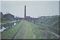
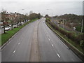
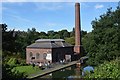
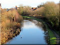
Photos of B66 1DY


Area Information
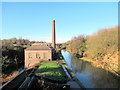
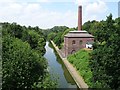
Living in B66 1DY means being part of a small, tightly knit residential cluster in the West Midlands, where history and modernity intersect. With a population of just 1,869, the area feels intimate, offering a quieter alternative to larger urban centres. Situated near Smethwick and the broader Black Country, the postcode sits within a region steeped in industrial heritage, from 19th-century glassworks to historic churches like St Paul’s in Birmingham. Daily life here is shaped by proximity to rail networks and local retail, with amenities within walking distance. The area’s compact size means a sense of community is strong, though it remains distinct from the bustling city centres. For those seeking a balance between heritage and convenience, B66 1DY offers a foothold in a region known for its industrial legacy, with modern infrastructure ensuring connectivity. The median age of 47 suggests a stable, mature population, many of whom may have ties to the area’s historical industries. Whether commuting to nearby cities or enjoying local amenities, residents benefit from a blend of practicality and rootedness in a place with a defined character.
- Area Type
- Postcode
- Area Size
- Not available
- Population
- 1869
- Population Density
- 14256 people/km²
The property market in B66 1DY is characterised by a focus on houses rather than flats, with 49% of homes owner-occupied. This suggests a mix of long-term residents and investors, though the small population of 1,869 means the housing stock is limited in scale. The area’s compact size means properties are likely to be in close proximity to each other, with little scope for expansion. For buyers, this creates a niche market where availability is constrained, and competition may be higher for specific properties. The predominance of houses over flats may appeal to those seeking more space or a traditional family home, though the lack of detailed data on property sizes or prices means potential buyers must conduct further local inquiries. The 49% home ownership rate also indicates that a significant portion of the housing stock is rented, which could influence rental yields for investors. Given the area’s historical ties to industry, properties may retain architectural features from earlier periods, adding character but requiring maintenance.
House Prices in B66 1DY
No properties found in this postcode.
Energy Efficiency in B66 1DY
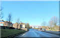
The lifestyle in B66 1DY is shaped by its proximity to retail and transport hubs. Within walking distance are shops such as Farmfoods West, Spar, and Asda Cape, providing essential daily needs. The area’s rail and metro stations, including Smethwick Rolfe Street and Trinity Way, offer access to broader networks, making it easy to reach leisure spots, cultural venues, or employment centres. While the data does not specify parks or recreational facilities, the presence of multiple retail points suggests a focus on practicality over leisure. The compact nature of the area means amenities are concentrated, reducing the need for long commutes. For those valuing convenience, the mix of retail, transport, and historical context creates a functional living environment. However, the absence of detailed information on green spaces or cultural attractions means buyers should investigate further for a full picture of the area’s character.
Amenities
Schools
| Rank | School | Type | Entry gender | Ages |
|---|
Explore more schools in this area
Go to Schools tabDemographics
The community in B66 1DY is predominantly composed of adults aged 30–64, with a median age of 47. This suggests a population that is largely established, with many likely employed in nearby industries or commuting to regional hubs. Home ownership here stands at 49%, indicating a mix of owner-occupied properties and rental units. The area’s accommodation is primarily houses, not flats, which is unusual for some urban postcode areas. The predominant ethnic group is Asian, reflecting broader demographic trends in the West Midlands. This diversity shapes the social fabric of the area, though specific data on cultural or religious practices is not provided. The absence of detailed deprivation metrics means it is difficult to assess socioeconomic challenges, but the age profile and housing stock suggest a stable, middle-aged population with established routines. For buyers, this demographic profile implies a community that values continuity and practicality, with a focus on long-term residency over transient living.
Household Size
Accommodation Type
Tenure
Ethnic Group
Religion
Household Composition
Age
Household Deprivation
NS-SEC
Explore more demographic insights in this area
Go to Demographics tabPlanning
Planning Constraints
- Flood RiskPremium
- Ramsar Wetland SitesPremium
- Area of Outstanding Natural BeautyPremium
- Protected Nature ReservePremium
- Protected WoodlandPremium