Area Overview for B65 9LT
Photos of B65 9LT
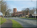
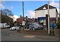
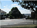
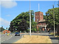
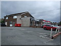
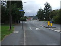
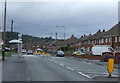

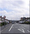

12 photos from this area
Area Information
Key information about the B65 9LT including its size, population, and administrative classification.
- Area Type
- Postcode
- Area Size
- 1.4 hectares
- Population
- 1752
- Population Density
- 5086 people/km²
House Prices in B65 9LT
40
Properties
£125,677
Average Sold Price
£33,000
Lowest Price
£230,000
Highest Price
Showing 40 properties
| Address | Type | Beds | Baths | Last Sale Price | Last Sale Date | |
|---|---|---|---|---|---|---|
| 8 Sandford Avenue, Rowley Regis, B65 9LT | Semi-detached | 3 | 1 | £201,199 | Oct 2024 | |
| 10 Sandford Avenue, Rowley Regis, B65 9LT | Semi-detached | 3 | 1 | £152,000 | Mar 2024 | |
| 69 Sandford Avenue, Rowley Regis, B65 9LT | Terraced | 2 | 1 | £170,000 | Nov 2023 | |
| 55 Sandford Avenue, Rowley Regis, B65 9LT | Semi-detached | 2 | 1 | £170,000 | Aug 2023 | |
| 68 Sandford Avenue, Rowley Regis, B65 9LT | Terraced | 2 | 2 | £170,000 | Jul 2022 | |
| 62 Sandford Avenue, Rowley Regis, B65 9LT | house | - | - | £230,000 | Feb 2022 | |
| 54 Sandford Avenue, Rowley Regis, B65 9LT | Semi-detached | 2 | 1 | £140,000 | Nov 2021 | |
| 14 Sandford Avenue, Rowley Regis, B65 9LT | Terraced | 3 | - | £185,000 | Sep 2021 | |
| 59 Sandford Avenue, Rowley Regis, B65 9LT | Terraced | 2 | 1 | £135,000 | Sep 2020 | |
| 53 Sandford Avenue, Rowley Regis, B65 9LT | Semi-detached | 3 | 1 | £150,000 | Feb 2020 |
Page 1 of 4
Energy Efficiency in B65 9LT
Amenities
Schools
| Rank | School | Type | Entry gender | Ages |
|---|
Explore more schools in this area
Go to Schools tabDemographics
Household Size
Family (3-5 people)
most common
Accommodation Type
Houses
most common
Tenure
52
majority
Ethnic Group
White
most common
Religion
N/A
most common
Household Composition
N/A
most common
Age
47
median
Adults (30-64 years)
most common
Household Deprivation
N/A
with no deprivation
NS-SEC
15
in Lower managerial occupations
Explore more demographic insights in this area
Go to Demographics tabPlanning
Planning Constraints
- Flood RiskPremium
- Ramsar Wetland SitesPremium
- Area of Outstanding Natural BeautyPremium
- Protected Nature ReservePremium
- Protected WoodlandPremium