Area Overview for B65 8TB
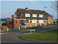
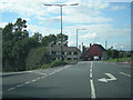
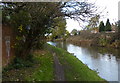
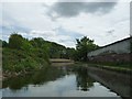
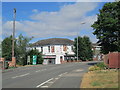
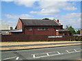
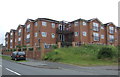
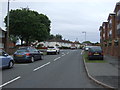
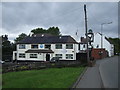
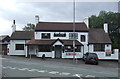
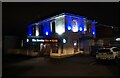
Photos of B65 8TB

Area Information
Living in B65 8TB means being part of a small, tightly knit residential cluster in the West Midlands, within Sandwell Metropolitan Borough Council. With a population of just 1,544, the area feels quiet and unassuming, yet it is strategically positioned near Rowley Regis, a town with historical roots in industrial and urban development. The postcode covers a compact cluster of homes, many of which are traditional houses, reflecting the area’s character as a settled, family-oriented community. Daily life here is shaped by proximity to local amenities, including schools, rail links, and retail outlets. The area’s history, from its Saxon-era religious sites to 19th-century industrial growth, adds depth to its modern identity. While it lacks the density of larger cities, B65 8TB offers a balance of practicality and tranquillity, with easy access to Birmingham and surrounding towns. Residents benefit from a mix of historical and contemporary infrastructure, including a hospital and active railway stations, making it a viable choice for those seeking a stable, low-maintenance lifestyle.
- Area Type
- Postcode
- Area Size
- Not available
- Population
- 1544
- Population Density
- 3752 people/km²
The property market in B65 8TB is characterised by a strong presence of owner-occupied homes, with 57% of properties owned by residents. The accommodation type is predominantly houses, which contrasts with areas where flats or apartments dominate. This suggests a market skewed towards family homes and long-term residency rather than a high turnover of rental properties. Given the small population and compact nature of the postcode, the housing stock is likely limited, meaning buyers may need to consider adjacent areas for more options. The emphasis on houses also implies that properties here are likely to be larger and more traditional in design, appealing to those seeking space and privacy. However, the absence of specific data on property prices or recent market trends means buyers should explore nearby postcodes for a fuller picture of availability and value.
House Prices in B65 8TB
No properties found in this postcode.
Energy Efficiency in B65 8TB
Daily life in B65 8TB is supported by a selection of nearby amenities, including retail outlets like Spar Rowley, Lidl Netherton, and Aldi Saltwells, which cater to everyday shopping needs. The area’s rail stations—Old Hill, Rowley Regis, and Cradley Heath—offer direct links to Birmingham and surrounding regions, while metro stops at Dartmouth Street, Lodge Road, and Dudley Street Guns Village provide additional transport options. These connections make it easy to access larger urban centres for work, leisure, or socialising. The presence of multiple retail stores suggests a convenience-focused environment, reducing the need for long trips to larger towns. While specific parks or leisure facilities are not detailed, the area’s proximity to Rowley Regis—a town with historical and cultural sites—implies opportunities for recreation and community engagement. The blend of practical amenities and transport links ensures a lifestyle that balances local comfort with regional accessibility.
Amenities
Schools
Residents of B65 8TB have access to a range of local schools, including Springfield Junior School and Springfield Infant and Nursery School, both primary institutions. Knowle School is a special needs school, providing tailored education for students with specific requirements, while Springfield Primary School holds an Ofsted rating of ‘good’. This mix of school types ensures families can find appropriate educational options, from early years care to mainstream primary education. The presence of a special school highlights the area’s commitment to inclusive learning, while the ‘good’ rating at Springfield Primary School indicates a reliable standard of teaching. For parents, the proximity of multiple schools reduces the need for long commutes, supporting a family-friendly lifestyle. The variety of educational provision also caters to different needs, making the area appealing to those prioritising accessible, well-rated schooling.
| Rank | School | Type | Entry gender | Ages |
|---|
Explore more schools in this area
Go to Schools tabDemographics
The community in B65 8TB is predominantly middle-aged, with a median age of 47 and the most common age range being adults aged 30–64. This suggests a population largely composed of working-age individuals and families, with fewer younger or older residents. Home ownership stands at 57%, indicating a mix of owner-occupied and rental properties, though the latter is not explicitly quantified. The accommodation type is primarily houses, reflecting a preference for single-family homes over flats or apartments. The predominant ethnic group is White, though specific data on diversity or deprivation is not provided. This age profile and housing stock imply a community focused on stability, with residents likely prioritising long-term residency over short-term rental flexibility. The lack of specific data on deprivation means the area’s quality of life cannot be assessed in terms of economic hardship, but the presence of schools, retail, and transport options suggests adequate local services.
Household Size
Accommodation Type
Tenure
Ethnic Group
Religion
Household Composition
Age
Household Deprivation
NS-SEC
Explore more demographic insights in this area
Go to Demographics tabPlanning
Planning Constraints
- Flood RiskPremium
- Ramsar Wetland SitesPremium
- Area of Outstanding Natural BeautyPremium
- Protected Nature ReservePremium
- Protected WoodlandPremium